|
search place name
|
||
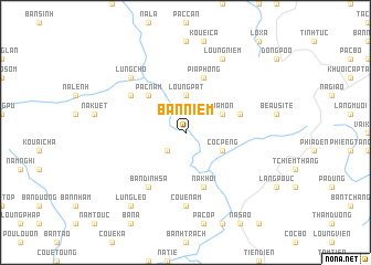
Bản Niêm (Vietnam)Bản Niêm is a town in Vietnam. An overview map of the region around Bản Niêm is displayed below.
regional and 3d topo map of Bản Niêm, Vietnam ::
Bản Niêm airports ::
The nearest airport is HAN - Hanoi Noibai Intl, located 150.9 km south of Bản Niêm.
Nearby towns ::
Bản Ma Chu (2.5km south west) //
Loung Pát (3.7km north) //
Côc Peng (3.9km south east) //
Na Mon (3.9km north east) //
Pac Nằm (5.0km north west) //
Pia Phong (5.8km north) //
Na Khôi (5.8km south) //
Bản Ðúng (5.5km east) //
Bản Chàp (6.3km north west) //
Bản Dinh Sa (6.5km south west) //
Coue Nam (7.4km south) //
Coc Mat (7.4km south) //
Lung Chô (7.6km north west) //
Loung Niem (8.2km north east) //
Lung Leo (9.0km south west) //
[all distances 'as the bird flies' and approximate] 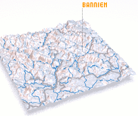 Places with similar names to Bản Niêm, Vietnam ::
Disclaimer :: Information on this page comes without warranty of any kind |
||
|
Where is Bản Niêm? Elevation and coordinates ::
Latitude (lat): 22°35'0"N Longitude (lon): 105°46'0"E
Elevation (approx.): 293m (map arrows pan, magnifying glasses zoom) |
||
|
Visiting Bản Niêm? Hotel/Accommodation ::
Book a hotel in Bản Niêm Travel Guide ::
Buy a travel guide for Vietnam rental cars ::
car rental offers GPS waypoint ::
download a GPX waypoint (PoI) of Bản Niêm for your GPS receiver
|
||