|
search place name
|
||
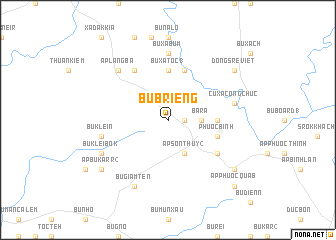
Bu Brieng (Sông Bé, Vietnam)Bu Brieng is a town in the Sông Bé region of Vietnam. An overview map of the region around Bu Brieng is displayed below.
regional and 3d topo map of Bu Brieng, Vietnam ::
Bu Brieng airports ::
The nearest airport is SGN - Ho Chi Minh City Tansonnhat Intl, located 116.4 km south of Bu Brieng.
Nearby towns ::
Bu Tron I (1.8km east) //
Bà Rá (3.6km east) //
Ấp Sơn Thủy (2) (4.1km south east) //
Ấp Hầm Ðá (5.4km east) //
Bu Xà Tốc (1) (5.6km north) //
Phước Bình (5.7km east) //
Bu Com Bên Brun (5.8km north) //
Ấp Phước Sỏn (6.6km south east) //
Bu Da Gro (6.6km north west) //
Bu Xà Bum (7.4km north) //
Bu Klein (7.5km west) //
Cư Xá Công Chức (7.5km east) //
Ấp Lang Ba (7.8km north west) //
Bu Giam Ten (8.3km south west) //
Bu Klei Bok (8.1km south west) //
Ấp Bu Karr (2) (9.1km south west) //
Ấp Phước Quả A (9.1km south east) //
Dong Sré Viẽt (9.1km north east) //
Ấp Phước Quả B (10.4km south east) //
[all distances 'as the bird flies' and approximate]  Places with similar names to Bu Brieng, Vietnam ::
// Bobrownik (PL)
// Bobrowniki (PL)
// Bobrowniki (PL)
// Bobrowniki (PL)
// Bobrowniki (PL)
// Bobrowniki (PL)
// Bobrowniki (PL)
// Bobrowniki (PL)
// Bobrowniki (PL)
// Bobrowniki (PL)
Disclaimer :: Information on this page comes without warranty of any kind |
||
|
Where is Bu Brieng? Elevation and coordinates ::
Latitude (lat): 11°50'0"N Longitude (lon): 106°56'0"E
Elevation (approx.): 238m (map arrows pan, magnifying glasses zoom) |
||
|
Visiting Bu Brieng? Hotel/Accommodation ::
Book a hotel in Bu Brieng Travel Guide ::
Buy a travel guide for Vietnam rental cars ::
car rental offers GPS waypoint ::
download a GPX waypoint (PoI) of Bu Brieng for your GPS receiver
|
||