|
search place name
|
||
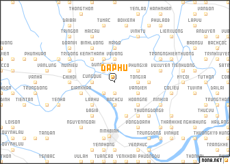
Ða Phú (Vietnam)Ða Phú is a town in Vietnam. An overview map of the region around Ða Phú is displayed below.
regional and 3d topo map of Ða Phú, Vietnam ::
Ða Phú airports ::
The nearest airport is HAN - Hanoi Noibai Intl, located 100.0 km north of Ða Phú.
Nearby towns ::
Hưng Xá (1.9km south) //
Giáp Giá (2.5km south west) //
Dũng Quyết (2.5km north west) //
Cung Quế (3.5km west) //
Bạch Cừ (3.7km south) //
Vô Vọng (3.7km north) //
Thiêm Lộc (3.5km east) //
Tống Xá (3.5km east) //
Lạc Chính (4.1km north west) //
Vạn Ðiểm (3.9km south east) //
Phùng Xá (3.9km north east) //
La Phù (5.1km south west) //
Kênh Thanh (5.1km north west) //
An Lộc (5.1km south east) //
Cát Ðằng (5.1km south east) //
Hoàng Nê (5.1km south east) //
Lũ Phong (5.2km east) //
Cổ Liêu (5.6km north) //
Mai Ðộ (5.6km north) //
Gian Khan (5.5km west) //
Phong Xuyên (5.8km south) //
Ða Gia (6.6km south west) //
Bình Lượng (6.6km north west) //
Cao Bồ (6.6km south east) //
Chi Hối (7.0km west) //
Núi Miêu (7.2km west) //
Vũ Xuyên (7.2km east) //
Thượng Ðồng (1) (7.6km south east) //
Vọng Doanh (8.2km south east) //
[all distances 'as the bird flies' and approximate]  Places with similar names to Ða Phú, Vietnam ::
Disclaimer :: Information on this page comes without warranty of any kind |
||
|
Where is Ða Phú? Elevation and coordinates ::
Latitude (lat): 20°20'0"N Longitude (lon): 105°59'0"E
Elevation (approx.): 3m (map arrows pan, magnifying glasses zoom) |
||
|
Visiting Ða Phú? Hotel/Accommodation ::
Book a hotel in Ða Phú Travel Guide ::
Buy a travel guide for Vietnam rental cars ::
car rental offers GPS waypoint ::
download a GPX waypoint (PoI) of Ða Phú for your GPS receiver
|
||