|
search place name
|
||
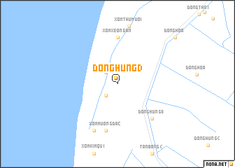
Ðông Hưng (3) (Kiến Giang, Vietnam)Ðông Hưng (3) is a town in the Kiến Giang region of Vietnam. An overview map of the region around Ðông Hưng (3) is displayed below.
regional and 3d topo map of Ðông Hưng (3), Vietnam ::
Ðông Hưng (3) airports ::
The nearest airport is PNH - Phnom-penh Phnom Penh Intl, located 208.0 km north of Ðông Hưng (3).
Other airports nearby include SGN - Ho Chi Minh City Tansonnhat Intl (230.4 km north east), Nearby towns ::
Xóm Ra Ghe (2.6km north west) //
Ðông Hưng (2) (2.6km south west) //
Xóm Xẻo Ngàn (7.4km north) //
Xóm Mương Ðắc (7.6km south) //
Ðông Hưng (1) (7.8km south east) //
Mương Ðào (8.3km south west) //
[all distances 'as the bird flies' and approximate] 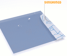 Places with similar names to Ðông Hưng (3), Vietnam ::
Disclaimer :: Information on this page comes without warranty of any kind |
||
|
Where is Ðông Hưng (3)? Elevation and coordinates ::
Latitude (lat): 9°40'0"N Longitude (lon): 104°54'0"E
Elevation (approx.): 5m (map arrows pan, magnifying glasses zoom) |
||
|
Visiting Ðông Hưng (3)? Hotel/Accommodation ::
Book a hotel in Ðông Hưng (3) Travel Guide ::
Buy a travel guide for Vietnam rental cars ::
car rental offers GPS waypoint ::
download a GPX waypoint (PoI) of Ðông Hưng (3) for your GPS receiver
|
||