|
search place name
|
||
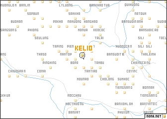
Kê Lio (Sơn La, Vietnam)Kê Lio is a town in the Sơn La region of Vietnam. An overview map of the region around Kê Lio is displayed below.
regional and 3d topo map of Kê Lio, Vietnam ::
Kê Lio airports ::
The nearest airport is HAN - Hanoi Noibai Intl, located 126.1 km east of Kê Lio.
Nearby towns ::
Pha Kanh (1.9km south) //
Co Phat (1.9km south) //
Lo Tai (1.9km south) //
Phieng Kanh (1.7km west) //
Ko Ha (1.7km west) //
Bản Ki Nu (1.9km north) //
Bản Giổi (1.9km north) //
Bô Côp (1.7km east) //
An Pon (2.5km south west) //
Bo Pâ (2.5km south west) //
Phieng Kuan (2.5km south east) //
Bản Hoa (2.5km north west) //
Piêng Dôn (2.5km north west) //
Ta An (2.5km north east) //
Nam Top (3.5km west) //
Tam Tiao (4.1km south east) //
Kon Uot (3.9km north west) //
Co Yin (1) (3.9km north west) //
Cố Mán (3.9km south east) //
Bô Lán (3.9km south east) //
Tâm Bu (3.9km south east) //
Bản Nam Tòm (3.9km south east) //
Ba Xenn (5.1km south east) //
Bản Suối Houc (5.1km south east) //
Ta Lai (5.1km north east) //
Mou Nao (5.6km south) //
Mon Ua (5.6km north) //
Ta Ping (5.5km west) //
Bản Pha Khen (6.4km south east) //
[all distances 'as the bird flies' and approximate] 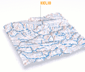 Places with similar names to Kê Lio, Vietnam ::
Disclaimer :: Information on this page comes without warranty of any kind |
||
|
Where is Kê Lio? Elevation and coordinates ::
Latitude (lat): 20°56'0"N Longitude (lon): 104°38'0"E
Elevation (approx.): 889m (map arrows pan, magnifying glasses zoom) |
||
|
Visiting Kê Lio? Hotel/Accommodation ::
Book a hotel in Kê Lio Travel Guide ::
Buy a travel guide for Vietnam rental cars ::
car rental offers GPS waypoint ::
download a GPX waypoint (PoI) of Kê Lio for your GPS receiver
|
||