|
search place name
|
||
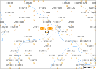
Khê Xuân (Vietnam)Khê Xuân is a town in Vietnam. An overview map of the region around Khê Xuân is displayed below.
regional and 3d topo map of Khê Xuân, Vietnam ::
Khê Xuân airports ::
The nearest airport is HAN - Hanoi Noibai Intl, located 153.2 km south east of Khê Xuân.
Nearby towns ::
Ðà Chặng (1.9km south) //
Khê Muôn (1.9km north) //
Khê Gủm (1.7km west) //
Ngòi Gióm (2.5km south east) //
Khê Bè (2.5km south west) //
Dồng Danh (2.5km north east) //
Làng Bàng (3.7km south) //
Khê Chê (3.7km north) //
Làng Trà (3.7km north) //
Làng Trạc (2) (3.9km north west) //
Làng Hut (3.9km north east) //
Trại Hút (5.1km north east) //
Xóm Có Quân (5.2km east) //
Làng Na (5.2km east) //
Làng Chò (1) (5.6km north) //
Làng Cỏ (5.6km south) //
Làng Trạc (1) (5.8km north) //
Làng Phả (5.8km north) //
Làng Cao (6.4km south west) //
Som Dông Dep (6.9km east) //
Ðộng Cuông (6.9km east) //
Khê Sẻ (7.4km north) //
Sóm Khê Trạm (6.9km east) //
Khê Ðanh (7.1km west) //
Khê Tchat (7.1km west) //
Ðá Chàng (7.6km south) //
Tong Tiên (7.1km east) //
Giáp Lẫm (7.6km north east) //
Làng Phả (7.6km north west) //
[all distances 'as the bird flies' and approximate]  Places with similar names to Khê Xuân, Vietnam ::
Disclaimer :: Information on this page comes without warranty of any kind |
||
|
Where is Khê Xuân? Elevation and coordinates ::
Latitude (lat): 21°57'0"N Longitude (lon): 104°33'0"E
Elevation (approx.): 114m (map arrows pan, magnifying glasses zoom) |
||
|
Visiting Khê Xuân? Hotel/Accommodation ::
Book a hotel in Khê Xuân Travel Guide ::
Buy a travel guide for Vietnam rental cars ::
car rental offers GPS waypoint ::
download a GPX waypoint (PoI) of Khê Xuân for your GPS receiver
|
||