|
search place name
|
||
Kỳ Vĩ (Vietnam)Kỳ Vĩ is a town in Vietnam. An overview map of the region around Kỳ Vĩ is displayed below.
regional and 3d topo map of Kỳ Vĩ, Vietnam ::

Kỳ Vĩ airports ::
The nearest airport is HAN - Hanoi Noibai Intl, located 108.8 km north of Kỳ Vĩ.
Nearby towns ::
Ninh Bình (1.0km north east) //
Phúc Trì (1.9km south) //
Yên Phong (1.9km south) //
Phúc Lộc (2.5km south east) //
Xuân Sơn (2.5km south west) //
Tuân Cáo (3.7km south) //
Ha Thôn (4.1km south east) //
Văn Lâm (4.1km south west) //
Ða Gia (4.1km north west) //
Nguyên Ngoại (3.9km north west) //
Phong Xuyên (5.1km north east) //
Yên Khoái (5.1km south east) //
Thiện Trạo (5.1km south east) //
Vũ Lâm (5.1km south west) //
Bạch Cừ (5.8km north) //
Dông Hội (5.8km south) //
Ðông Thịnh (5.8km south) //
Vọng Doanh (5.5km east) //
Yên Phúc (5.5km east) //
Xuân Vũ (5.8km south) //
La Phù (5.8km north) //
Yên Khang (6.4km south east) //
Cao Bồ (6.4km north east) //
Trung Dông (7.0km east) //
Giáp Giá (7.4km north) //
Ðái Sơn (7.4km south) //
Ngọc Chấn (7.2km east) //
Hưng Xá (7.6km north) //
Phú Lăng (7.6km south) //
[all distances 'as the bird flies' and approximate] 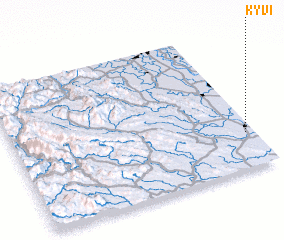 Places with similar names to Kỳ Vĩ, Vietnam ::
Disclaimer :: Information on this page comes without warranty of any kind |
||
|
Where is Kỳ Vĩ? Elevation and coordinates ::
Latitude (lat): 20°15'0"N Longitude (lon): 105°58'0"E
Elevation (approx.): 7m (map arrows pan, magnifying glasses zoom) |
||
|
Visiting Kỳ Vĩ? Hotel/Accommodation ::
Book a hotel in Kỳ Vĩ Travel Guide ::
Buy a travel guide for Vietnam rental cars ::
car rental offers GPS waypoint ::
download a GPX waypoint (PoI) of Kỳ Vĩ for your GPS receiver
|
||