|
search place name
|
||
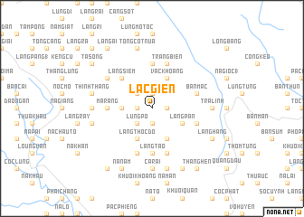
Lạc Giển (Cao Bằng, Vietnam)Lạc Giển is a town in the Cao Bằng region of Vietnam. An overview map of the region around Lạc Giển is displayed below.
regional and 3d topo map of Lạc Giển, Vietnam ::
Lạc Giển airports ::
The nearest airport is HAN - Hanoi Noibai Intl, located 184.3 km south of Lạc Giển.
Other airports nearby include NNG - Nanning Wuxu (199.1 km east), Nearby towns ::
Khôn Sà (1.9km south) //
Làng Nặm (1.9km north) //
Nặm Goằm (1.7km east) //
Làng Sỏm (1.7km west) //
Lủng Pỏ (2.5km south west) //
Ca Pắng (2.5km north west) //
Lung Khoen (3.4km west) //
Làng Pàn (3.9km south east) //
Làng Rượi (4.1km south east) //
Làng Thốc Ðo (4.1km south west) //
Làng Rọt (4.1km south east) //
Vac Khoang (4.1km north east) //
Làng Siềm (5.0km north west) //
Ma Rảng (5.1km west) //
Co Tó (5.6km north) //
Làng Tao (5.6km south) //
Làng Kinh (5.4km east) //
Bản Măc (5.4km east) //
Kéo Khao (5.8km south) //
Làng Giước (5.8km south) //
Tráng Biên (5.8km north) //
Cả Xát (6.3km north west) //
Ca Rài (7.4km south) //
Làng Nung (6.8km west) //
Trà Linh (6.8km east) //
BácLục (7.6km south) //
Chắm Ché Húa (7.1km west) //
Thinh Thăng (7.1km west) //
Tổng Cot Nua (7.6km north) //
[all distances 'as the bird flies' and approximate]  Places with similar names to Lạc Giển, Vietnam ::
Disclaimer :: Information on this page comes without warranty of any kind |
||
|
Where is Lạc Giển? Elevation and coordinates ::
Latitude (lat): 22°50'0"N Longitude (lon): 106°15'0"E
Elevation (approx.): 639m (map arrows pan, magnifying glasses zoom) |
||
|
Visiting Lạc Giển? Hotel/Accommodation ::
Book a hotel in Lạc Giển Travel Guide ::
Buy a travel guide for Vietnam rental cars ::
car rental offers GPS waypoint ::
download a GPX waypoint (PoI) of Lạc Giển for your GPS receiver
|
||