|
search place name
|
||
Làng Giang (1) (Vietnam)Làng Giang (1) is a town in Vietnam. An overview map of the region around Làng Giang (1) is displayed below.
regional and 3d topo map of Làng Giang (1), Vietnam ::

Làng Giang (1) airports ::
The nearest airport is HAN - Hanoi Noibai Intl, located 115.3 km south east of Làng Giang (1).
Nearby towns ::
Khuôn Chinh (1.9km north) //
Thác Vàng (1.9km north) //
Làng Nàn (1.7km west) //
Làng Ném (1.9km south) //
Làng Súng (2.5km south west) //
Làng Diệo (3.4km west) //
Làng Bình (3.7km north) //
Khuốn Thuốc (3.7km south) //
Khâu Me (3.7km south) //
Làng Giang (2) (3.7km south) //
Kê Khê (3.4km east) //
Làng Cạn (3.9km north west) //
Vườn Thưa (3.9km north west) //
Làng Nhà Giàng (4.1km north west) //
Làng Xuân (4.1km north east) //
Ngòi Quan (3.9km north east) //
Làng Dấy (4.1km south west) //
Phúc Lâm (3.9km south east) //
Ngòi Hanh (5.1km north east) //
Ðồng Tranh (5.1km south east) //
Hoi Ðâu (5.2km west) //
Làng Mần (5.6km south) //
Chợ Ngọc (5.8km north) //
Cửa Ngài (5.5km east) //
Làng Chẽ (6.4km north west) //
Làng Uân (6.4km south east) //
Xinh La (6.4km south west) //
Làng Chùa (6.4km south east) //
Làng Sinh (6.4km south east) //
[all distances 'as the bird flies' and approximate] 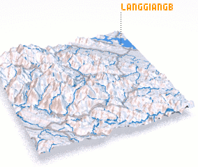 Places with similar names to Làng Giang (1), Vietnam ::
// Làng Giồng (1) (VN)
// Làng Noc (1) (VN)
Disclaimer :: Information on this page comes without warranty of any kind |
||
|
Where is Làng Giang (1)? Elevation and coordinates ::
Latitude (lat): 21°52'0"N Longitude (lon): 104°56'0"E
Elevation (approx.): 53m (map arrows pan, magnifying glasses zoom) |
||
|
Visiting Làng Giang (1)? Hotel/Accommodation ::
Book a hotel in Làng Giang (1) Travel Guide ::
Buy a travel guide for Vietnam rental cars ::
car rental offers GPS waypoint ::
download a GPX waypoint (PoI) of Làng Giang (1) for your GPS receiver
|
||