|
search place name
|
||
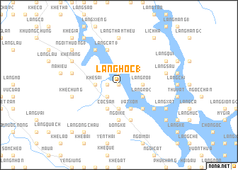
Làng Hộc (1) (Vietnam)Làng Hộc (1) is a town in Vietnam. An overview map of the region around Làng Hộc (1) is displayed below.
regional and 3d topo map of Làng Hộc (1), Vietnam ::
Làng Hộc (1) airports ::
The nearest airport is HAN - Hanoi Noibai Intl, located 135.5 km south east of Làng Hộc (1).
Nearby towns ::
Vạn Thiều (0.0km north) //
Làng Quả (1.7km west) //
Làng Chắng (1.9km north) //
Làng Ðát (2.5km south west) //
Khê Sài (3.4km west) //
Khê Hàm (3.7km south) //
Làng Ro (1) (3.4km east) //
Cóc Sâm (4.1km south west) //
Vật Xóm (4.1km south east) //
Lũng Hà (4.1km south east) //
Làng Ro (2) (3.9km south east) //
Bản Lôi Quông (5.1km south east) //
Làng Ðồng Bát (5.1km south east) //
Ngòi Kè (5.6km south) //
Làng Cát (1) (5.8km north) //
Khê Nhàn (5.8km south) //
Khê Cha (6.5km north west) //
Làng Riếng (6.4km south east) //
Bản Ðụng Xá (6.4km south east) //
Ðông Kê (7.4km south) //
Làng Thâm Thêu (7.4km north) //
Khê Chung (7.1km west) //
Khê Kiêng (7.1km west) //
Làng Sầu (7.1km east) //
Khê Cáng (7.8km north west) //
Khê Nang (7.8km north west) //
Làng Xát (7.8km south east) //
Hương Giang (7.8km north east) //
Làng Qui (7.8km north east) //
[all distances 'as the bird flies' and approximate] 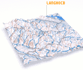 Places with similar names to Làng Hộc (1), Vietnam :: Disclaimer :: Information on this page comes without warranty of any kind |
||
|
Where is Làng Hộc (1)? Elevation and coordinates ::
Latitude (lat): 21°59'0"N Longitude (lon): 104°47'0"E
Elevation (approx.): 53m (map arrows pan, magnifying glasses zoom) |
||
|
Visiting Làng Hộc (1)? Hotel/Accommodation ::
Book a hotel in Làng Hộc (1) Travel Guide ::
Buy a travel guide for Vietnam rental cars ::
car rental offers GPS waypoint ::
download a GPX waypoint (PoI) of Làng Hộc (1) for your GPS receiver
|
||