|
search place name
|
||
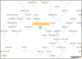
Làng Suong (Vietnam)Làng Suong is a town in Vietnam. An overview map of the region around Làng Suong is displayed below.
regional and 3d topo map of Làng Suong, Vietnam ::
Làng Suong airports ::
The nearest airport is HAN - Hanoi Noibai Intl, located 202.4 km south east of Làng Suong.
Nearby towns ::
Làng Tchoung (1.7km east) //
Làng Ha (1.7km east) //
Nam Uieu (2.5km north west) //
Na Sao (4.1km south east) //
Làng Pinh (4.1km north west) //
Làng Xa (3.9km south east) //
Làng Luo (5.0km south east) //
Phương Dộ (5.1km west) //
Bản Man (5.8km north) //
Na Rei (5.8km north) //
Na Lang (5.4km east) //
Coc Nié (6.3km north west) //
Làng Me (6.3km south east) //
Phương Dô (6.3km south east) //
Hà Giang (7.1km east) //
Na Ton (7.6km north west) //
Bản Na Dinh (7.6km north east) //
Làng Lap (8.8km south east) //
Lan Hung (9.0km south east) //
Thanh Thủy (10.1km north west) //
[all distances 'as the bird flies' and approximate]  Places with similar names to Làng Suong, Vietnam ::
Disclaimer :: Information on this page comes without warranty of any kind |
||
|
Where is Làng Suong? Elevation and coordinates ::
Latitude (lat): 22°51'0"N Longitude (lon): 104°55'0"E
Elevation (approx.): 314m (map arrows pan, magnifying glasses zoom) |
||
|
Visiting Làng Suong? Hotel/Accommodation ::
Book a hotel in Làng Suong Travel Guide ::
Buy a travel guide for Vietnam rental cars ::
car rental offers GPS waypoint ::
download a GPX waypoint (PoI) of Làng Suong for your GPS receiver
|
||