|
search place name
|
||
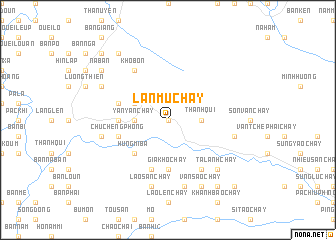
Lan Mu Chay (Vietnam)Lan Mu Chay is a town in Vietnam. An overview map of the region around Lan Mu Chay is displayed below.
regional and 3d topo map of Lan Mu Chay, Vietnam ::
Lan Mu Chay airports ::
The nearest airport is HAN - Hanoi Noibai Intl, located 204.9 km east of Lan Mu Chay.
Nearby towns ::
Yan Mo Chay (0.0km north) //
Thanh Quì (3.4km east) //
Ma Phang Sung Chay (3.4km east) //
Suối Thi Pha (3.4km west) //
Yan Yan Chay (3.4km west) //
Kho Bôn (3.9km north west) //
Hủng Mi Bá (5.1km south west) //
Co Gi San (5.6km south) //
Gia Khô Chay (5.6km south) //
Suối Lao Chay (5.2km west) //
Chay Hi Ho (5.8km south) //
Chú Chếng Phòng (5.5km west) //
Con Sum (5.5km west) //
Sấn Chay (6.5km south east) //
Lao Chông Khoan Chay (6.5km south east) //
Kho Bon (6.5km north west) //
Son Chay (1) (7.1km east) //
Lai Mu Lao Chay (7.6km south) //
Lân Than Chay (7.6km south) //
Bản La (7.1km west) //
Lao San Chay (7.6km south) //
Lao Chay (7.6km south east) //
Lao Tchế Phay Chay (7.6km south east) //
Ta Lanh Chay (7.6km south east) //
Van Sao Chay (8.2km south east) //
Han Lam (7.8km north west) //
Ho Sao Chay (9.0km south east) //
Bản Long (8.8km north west) //
Na Ban (8.8km north west) //
[all distances 'as the bird flies' and approximate] 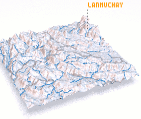 Places with similar names to Lan Mu Chay, Vietnam :: Disclaimer :: Information on this page comes without warranty of any kind |
||
|
Where is Lan Mu Chay? Elevation and coordinates ::
Latitude (lat): 21°54'0"N Longitude (lon): 103°58'0"E
Elevation (approx.): 1159m (map arrows pan, magnifying glasses zoom) |
||
|
Visiting Lan Mu Chay? Hotel/Accommodation ::
Book a hotel in Lan Mu Chay Travel Guide ::
Buy a travel guide for Vietnam rental cars ::
car rental offers GPS waypoint ::
download a GPX waypoint (PoI) of Lan Mu Chay for your GPS receiver
|
||