|
search place name
|
||
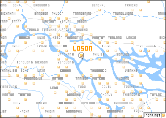
Lỗ Sơn (Hải Hưng, Vietnam)Lỗ Sơn is a town in the Hải Hưng region of Vietnam. An overview map of the region around Lỗ Sơn is displayed below.
regional and 3d topo map of Lỗ Sơn, Vietnam ::
Lỗ Sơn airports ::
The nearest airport is HAN - Hanoi Noibai Intl, located 82.1 km west of Lỗ Sơn.
Other airports nearby include NNG - Nanning Wuxu (242.1 km north east), Nearby towns ::
Pháp Cổ (1.7km east) //
Hoàng Thạch (2.5km north east) //
Châu Xá (2.5km north west) //
Phi Liệt (3.5km east) //
Thượng Triểu (3.7km north) //
Hạ Chiểu (3.7km north) //
Kinh Môn (3.7km south) //
An Ninh Nội (3.7km south) //
Vạn Chánh (3.5km west) //
Mạo Khê (4.1km north east) //
Bìch Nhôi (4.1km north east) //
Thượng Trà (4.1km north west) //
Doan Lại (4.1km south east) //
Phù Lưu Nội (4.1km south east) //
Duyên Linh (3.9km north west) //
Nghĩa Vũ (3.9km south west) //
Yên Cương (3.9km south west) //
Vĩnh Tuy (5.1km north east) //
Thương Cỏi (5.1km south east) //
An Lãng (5.1km south west) //
Kinh Ha (5.1km south west) //
Tông Xá Hạ (5.6km south) //
Kim Xuyên (5.2km west) //
Trại Sơn (5.6km south) //
Nhuệ Hổ (5.6km north) //
Tử Lạc (5.5km east) //
Dương Nham (5.5km west) //
Kim Sen (5.8km north) //
Cổ Giản (5.8km north) //
[all distances 'as the bird flies' and approximate] 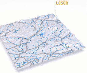 Places with similar names to Lỗ Sơn, Vietnam ::
Disclaimer :: Information on this page comes without warranty of any kind |
||
|
Where is Lỗ Sơn? Elevation and coordinates ::
Latitude (lat): 21°1'0"N Longitude (lon): 106°34'0"E
Elevation (approx.): 3m (map arrows pan, magnifying glasses zoom) |
||
|
Visiting Lỗ Sơn? Hotel/Accommodation ::
Book a hotel in Lỗ Sơn Travel Guide ::
Buy a travel guide for Vietnam rental cars ::
car rental offers GPS waypoint ::
download a GPX waypoint (PoI) of Lỗ Sơn for your GPS receiver
|
||