|
search place name
|
||
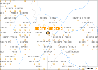
Ngay Phung Cho (Vietnam)Ngay Phung Cho is a town in Vietnam. An overview map of the region around Ngay Phung Cho is displayed below.
regional and 3d topo map of Ngay Phung Cho, Vietnam ::
Ngay Phung Cho airports ::
The nearest airport is HAN - Hanoi Noibai Intl, located 223.3 km south east of Ngay Phung Cho.
Nearby towns ::
Sen Tchou (0.0km north) //
Hoa Si Pan (1.9km north) //
Pan Tsin (1.7km east) //
Su Ngan Than (1.9km south) //
Lao Ti Phong (2.5km north east) //
Kou Pa (2.5km south east) //
Soei Ngan Táng (2.5km south east) //
Kan Ho (2.5km south west) //
Man Mei (3.4km west) //
Pan Pho (3.9km north west) //
Hia Man Ten (3.9km north west) //
Chang Man Ten (3.9km north west) //
Pa Ke (3.9km north east) //
Giao Khai Hoa (4.1km north east) //
Long Phong (4.1km north west) //
Nam Kang (4.1km north east) //
Làng Mo Kai (3.9km south east) //
Quang Ten San (4.1km south west) //
Ta Tchai (5.0km north west) //
Si Ma Kai (5.0km north west) //
Quang Ten San (5.0km south west) //
Nan Kang (5.0km south east) //
Ta Pa Tchai (5.1km east) //
Pan Pho (1) (5.6km south) //
Ta Wan Tzeu (5.6km south) //
Sin Tchang (5.5km west) //
Lao In Pan (5.5km east) //
Yao In San (5.8km north) //
Nam Quât (5.8km south) //
[all distances 'as the bird flies' and approximate] 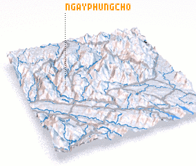 Places with similar names to Ngay Phung Cho, Vietnam :: Disclaimer :: Information on this page comes without warranty of any kind |
||
|
Where is Ngay Phung Cho? Elevation and coordinates ::
Latitude (lat): 22°40'0"N Longitude (lon): 104°18'0"E
Elevation (approx.): 1324m (map arrows pan, magnifying glasses zoom) |
||
|
Visiting Ngay Phung Cho? Hotel/Accommodation ::
Book a hotel in Ngay Phung Cho Travel Guide ::
Buy a travel guide for Vietnam rental cars ::
car rental offers GPS waypoint ::
download a GPX waypoint (PoI) of Ngay Phung Cho for your GPS receiver
|
||