|
search place name
|
||
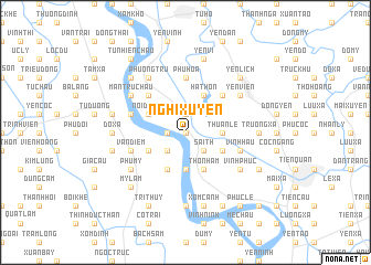
Nghi Xuyên (Hải Hưng, Vietnam)Nghi Xuyên is a town in the Hải Hưng region of Vietnam. An overview map of the region around Nghi Xuyên is displayed below.
regional and 3d topo map of Nghi Xuyên, Vietnam ::
Nghi Xuyên airports ::
The nearest airport is HAN - Hanoi Noibai Intl, located 51.2 km north of Nghi Xuyên.
Nearby towns ::
Phù Xa (0.0km north) //
Ninh Tâu (1.7km west) //
Kinh Khê (1.9km north) //
Sài Th (2.5km south east) //
Duyên Yết (2.5km south west) //
Thuần Lễ (3.5km east) //
Duyên Trang (3.7km south) //
Thọ Nham (4.1km south east) //
Hương Quất (3.9km south east) //
Phó Nham (4.1km south east) //
Phong Triều (4.1km south west) //
Hạ Thon (4.1km north east) //
Co Chau (3.9km south west) //
Nội Doanh (3.9km north west) //
Tiểu Quan (5.1km north east) //
Ðông Kết (5.1km north west) //
Phú Hòa (5.6km north) //
Vinh Hậu (5.5km east) //
Vạn Diểm (5.5km west) //
Dang Thon (5.5km west) //
Lưu Khê (5.5km west) //
Vĩnh Phúc (6.4km south east) //
Phú Mỹ (6.4km south west) //
Nam Quất (6.4km south west) //
Yên Viên (6.4km north east) //
Cao Quán (6.4km north east) //
Phương Trù (6.6km north west) //
Hà Vĩ (6.4km north west) //
Man Tru Chau (6.4km north west) //
[all distances 'as the bird flies' and approximate] 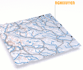 Places with similar names to Nghi Xuyên, Vietnam :: Disclaimer :: Information on this page comes without warranty of any kind |
||
|
Where is Nghi Xuyên? Elevation and coordinates ::
Latitude (lat): 20°47'0"N Longitude (lon): 105°58'0"E
Elevation (approx.): 9m (map arrows pan, magnifying glasses zoom) |
||
|
Visiting Nghi Xuyên? Hotel/Accommodation ::
Book a hotel in Nghi Xuyên Travel Guide ::
Buy a travel guide for Vietnam rental cars ::
car rental offers GPS waypoint ::
download a GPX waypoint (PoI) of Nghi Xuyên for your GPS receiver
|
||