|
search place name
|
||
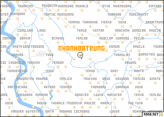
Nhân Hòa Trung (Hải Hưng, Vietnam)Nhân Hòa Trung is a town in the Hải Hưng region of Vietnam. An overview map of the region around Nhân Hòa Trung is displayed below.
regional and 3d topo map of Nhân Hòa Trung, Vietnam ::
Nhân Hòa Trung airports ::
The nearest airport is HAN - Hanoi Noibai Intl, located 45.1 km north west of Nhân Hòa Trung.
Nearby towns ::
Thư Th (1.9km north) //
Sài Trang (1.7km west) //
Xuân Tảo (1.7km east) //
Nhân Hòa Thương (1.7km east) //
Thanh Nga (1.7km west) //
Ðông Mỹ (2.5km south east) //
Tử Ðông (3.7km south) //
Dịch Trì (3.7km north) //
Yên Lão (3.7km north) //
Liêu Thượng (3.7km north) //
Luc Ðiền (3.9km south west) //
Ðông Than (3.9km north west) //
Yén Do (4.1km south east) //
Da Si (5.1km north east) //
Mỹ Hào (5.1km north east) //
Thuần Xuyên (5.2km east) //
Yên Xá (5.6km north) //
Phú Ða (5.6km north) //
Yên Dân (5.5km west) //
Ðồng Thành (5.5km east) //
Ðặng Xá (5.8km south) //
Truc Khu (5.8km south) //
Yên Lạc (6.6km south west) //
Yên Lịch (6.6km south west) //
Yên Tập (6.5km north east) //
Gia Côc (6.6km south east) //
Ngọc Lập (6.4km north east) //
Ốc Nhiêu (6.4km north west) //
Từ Hồ (6.9km west) //
[all distances 'as the bird flies' and approximate]  Places with similar names to Nhân Hòa Trung, Vietnam :: Disclaimer :: Information on this page comes without warranty of any kind |
||
|
Where is Nhân Hòa Trung? Elevation and coordinates ::
Latitude (lat): 20°53'0"N Longitude (lon): 106°3'0"E
Elevation (approx.): 6m (map arrows pan, magnifying glasses zoom) |
||
|
Visiting Nhân Hòa Trung? Hotel/Accommodation ::
Book a hotel in Nhân Hòa Trung Travel Guide ::
Buy a travel guide for Vietnam rental cars ::
car rental offers GPS waypoint ::
download a GPX waypoint (PoI) of Nhân Hòa Trung for your GPS receiver
|
||