|
search place name
|
||
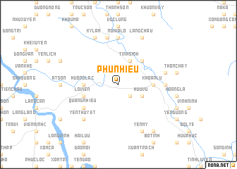
Phu Nhiêu (Vietnam)Phu Nhiêu is a town in Vietnam. An overview map of the region around Phu Nhiêu is displayed below.
regional and 3d topo map of Phu Nhiêu, Vietnam ::
Phu Nhiêu airports ::
The nearest airport is HAN - Hanoi Noibai Intl, located 54.5 km south east of Phu Nhiêu.
Nearby towns ::
Dũng Vi (2.5km south east) //
Tinh Sinh (4.1km north east) //
Hữu Vu (3.9km south east) //
Linh Xuyên (5.1km north east) //
Hương Lạc (5.2km west) //
Gia Cát (5.2km west) //
Khoan Lư (5.2km east) //
Lộ Viên (5.5km west) //
Quang Nhiêu (6.4km south west) //
Hội Kế (6.9km east) //
Nghĩa Lộ (7.4km north) //
Thiện Kế (7.1km east) //
Làng Lâm (7.6km north) //
Yên Thuyết (7.6km south west) //
Làng Chậu (8.2km north east) //
Yên Mỹ (8.2km south east) //
Kỳ Lâm (8.2km north west) //
Ngọc Kỹ (9.0km south east) //
[all distances 'as the bird flies' and approximate] 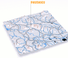 Places with similar names to Phu Nhiêu, Vietnam ::
Disclaimer :: Information on this page comes without warranty of any kind |
||
|
Where is Phu Nhiêu? Elevation and coordinates ::
Latitude (lat): 21°33'0"N Longitude (lon): 105°25'0"E
Elevation (approx.): 70m (map arrows pan, magnifying glasses zoom) |
||
|
Visiting Phu Nhiêu? Hotel/Accommodation ::
Book a hotel in Phu Nhiêu Travel Guide ::
Buy a travel guide for Vietnam rental cars ::
car rental offers GPS waypoint ::
download a GPX waypoint (PoI) of Phu Nhiêu for your GPS receiver
|
||