|
search place name
|
||
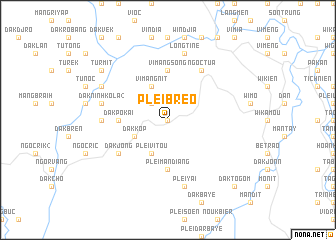
Plei Breo (Vietnam)Plei Breo is a town in Vietnam. An overview map of the region around Plei Breo is displayed below.
regional and 3d topo map of Plei Breo, Vietnam ::
Plei Breo airports ::
The nearest airport is DAD - Danang Intl, located 124.2 km north of Plei Breo.
Nearby towns ::
Vi Juih (0.0km north) //
Ngoc Thinh (2.6km north west) //
Plei Vitou (4.1km south west) //
Dak Kop (4.0km south west) //
Vimang Nit (4.1km north west) //
Dak Pokai (5.4km west) //
Plei Djak (5.6km south) //
Plei Man Diang (5.6km south) //
Vimang Song (5.6km north) //
Dak Jong (6.5km south west) //
Ngoc Tua (6.6km north east) //
Dak Breh (7.2km west) //
Plei Yai (7.6km south) //
Long Tine (7.6km north) //
Dak Ninh Kola (2) (7.4km west) //
Dak Klong (8.1km north west) //
Turmit (9.1km north west) //
Daktogom (10.3km south east) //
[all distances 'as the bird flies' and approximate] 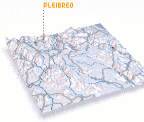 Places with similar names to Plei Breo, Vietnam ::
// Palibāri (BD)
// Poālbāria (BD)
// Palbaru (ID)
// Palohbaroh (ID)
// Puilboreau (FR)
// Puyloubier (FR)
// Pilbara (AU)
Disclaimer :: Information on this page comes without warranty of any kind |
||
|
Where is Plei Breo? Elevation and coordinates ::
Latitude (lat): 14°56'0"N Longitude (lon): 108°22'0"E
Elevation (approx.): 958m (map arrows pan, magnifying glasses zoom) |
||
|
Visiting Plei Breo? Hotel/Accommodation ::
Book a hotel in Plei Breo Travel Guide ::
Buy a travel guide for Vietnam rental cars ::
car rental offers GPS waypoint ::
download a GPX waypoint (PoI) of Plei Breo for your GPS receiver
|
||