|
search place name
|
||
Sài Trang (Hải Hưng, Vietnam)Sài Trang is a town in the Hải Hưng region of Vietnam. An overview map of the region around Sài Trang is displayed below.
regional and 3d topo map of Sài Trang, Vietnam ::

Sài Trang airports ::
The nearest airport is HAN - Hanoi Noibai Intl, located 44.2 km north west of Sài Trang.
Nearby towns ::
Thanh Nga (0.0km north) //
Nhân Hòa Trung (1.7km east) //
Luc Ðiền (2.5km south west) //
Ðông Than (2.5km north west) //
Thư Th (2.5km north east) //
Nhân Hòa Thương (3.5km east) //
Xuân Tảo (3.5km east) //
Yên Dân (3.9km south west) //
Tử Ðông (4.1km south east) //
Ðông Mỹ (3.9km south east) //
Dịch Trì (4.1km north east) //
Yên Lão (4.1km north east) //
Liêu Thượng (4.1km north east) //
Ốc Nhiêu (5.1km north west) //
Yén Do (5.1km south east) //
Bình Phú (5.2km west) //
Từ Hồ (5.2km west) //
Yên Lịch (5.8km south) //
Yên Lạc (5.8km south) //
Ðại Hạnh (5.5km west) //
Phú Ða (5.8km north) //
Yên Xá (5.8km north) //
Yên Vĩ (6.4km south west) //
Ðặng Xá (6.6km south east) //
Truc Khu (6.6km south east) //
Mỹ Hào (6.4km north east) //
Da Si (6.4km north east) //
Yên Phú (7.4km north) //
Bẩn Yên Nhân (7.4km north) //
[all distances 'as the bird flies' and approximate] 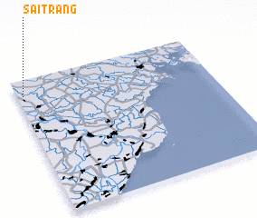 Places with similar names to Sài Trang, Vietnam ::
Disclaimer :: Information on this page comes without warranty of any kind |
||
|
Where is Sài Trang? Elevation and coordinates ::
Latitude (lat): 20°53'0"N Longitude (lon): 106°2'0"E
Elevation (approx.): 8m (map arrows pan, magnifying glasses zoom) |
||
|
Visiting Sài Trang? Hotel/Accommodation ::
Book a hotel in Sài Trang Travel Guide ::
Buy a travel guide for Vietnam rental cars ::
car rental offers GPS waypoint ::
download a GPX waypoint (PoI) of Sài Trang for your GPS receiver
|
||