|
search place name
|
||
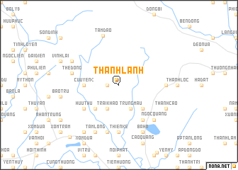
Thanh Lạnh (Vĩnh Phú, Vietnam)Thanh Lạnh is a town in the Vĩnh Phú region of Vietnam. An overview map of the region around Thanh Lạnh is displayed below.
regional and 3d topo map of Thanh Lạnh, Vietnam ::
Thanh Lạnh airports ::
The nearest airport is HAN - Hanoi Noibai Intl, located 23.1 km south east of Thanh Lạnh.
Nearby towns ::
Xạ Hưng (1.7km west) //
Trung Mậu (4.1km south east) //
Gia Du (4.1km south west) //
Trại Khao (4.1km south west) //
Mỹ Khê (5.1km south east) //
Cổ Ðô (5.1km south west) //
Cửu Yên (2) (5.2km west) //
Hữu Thủ (6.4km south west) //
Bảo Sơn (6.5km south east) //
Thiện Kế (7.4km south) //
Làng Tiêm (6.9km east) //
Quang Khai (7.6km south) //
Thê Ðồng (7.1km west) //
Ngọc Quang (7.6km south east) //
Tam Ðảo (8.2km north) //
Thanh Cao (7.8km south east) //
Bá Hạ (8.2km south east) //
Tam Lộng (8.2km south west) //
Làng Hạ (7.8km north west) //
Háu Nữ (9.0km south west) //
Thu Thach Thon (9.0km south west) //
Vĩnh Yên (10.9km south west) //
[all distances 'as the bird flies' and approximate]  Places with similar names to Thanh Lạnh, Vietnam ::
// Thanlun (MM)
// Theinlin (MM)
// Theinlon (MM)
// Thonlin (MM)
// Thanh Lân (VN)
// Thanh Liên (VN)
// Thanh Linh (VN)
// Thanh Luận (VN)
// Thiền Liền (VN)
// Thiên Linh (VN)
Disclaimer :: Information on this page comes without warranty of any kind |
||
|
Where is Thanh Lạnh? Elevation and coordinates ::
Latitude (lat): 21°23'0"N Longitude (lon): 105°40'0"E
Elevation (approx.): 283m (map arrows pan, magnifying glasses zoom) |
||
|
Visiting Thanh Lạnh? Hotel/Accommodation ::
Book a hotel in Thanh Lạnh Travel Guide ::
Buy a travel guide for Vietnam rental cars ::
car rental offers GPS waypoint ::
download a GPX waypoint (PoI) of Thanh Lạnh for your GPS receiver
|
||