|
search place name
|
||
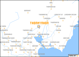
Thôn Mỹ Nhơn (Vietnam)Thôn Mỹ Nhơn is a town in Vietnam. An overview map of the region around Thôn Mỹ Nhơn is displayed below.
regional and 3d topo map of Thôn Mỹ Nhơn, Vietnam ::
Thôn Mỹ Nhơn airports ::
The nearest airport is NHA - Nhatrang, located 64.4 km north of Thôn Mỹ Nhơn.
Nearby towns ::
Gò Ðền (1.9km south) //
Thôn Phước Nhơn (3.6km west) //
Thôn Hòn Thiêng (3.7km south) //
Thôn Hội Diêm (4.1km south west) //
Thôn Phướng Cựu (4.1km south east) //
Thôn Cà Ðú (5.2km south west) //
Làng Ông (5.2km north east) //
Thôn An Xuân (5.8km west) //
Thôn Bà Râu (5.8km north) //
Thôn Dư Khánh (7.4km south) //
Thôn Nhơn Sơn (7.4km south) //
Thuận Hang (7.5km east) //
Thôn Trị Thủy (7.6km south) //
Thôn Thành Ý (7.8km south west) //
Ðồng Dầy (9.2km north west) //
Thôn Tân Hội (9.2km south west) //
Khánh Phước (10.4km south east) //
[all distances 'as the bird flies' and approximate]  Places with similar names to Thôn Mỹ Nhơn, Vietnam ::
// Thôn Miên Hoan (VN)
Disclaimer :: Information on this page comes without warranty of any kind |
||
|
Where is Thôn Mỹ Nhơn? Elevation and coordinates ::
Latitude (lat): 11°40'0"N Longitude (lon): 109°2'0"E
Elevation (approx.): 5m (map arrows pan, magnifying glasses zoom) |
||
|
Visiting Thôn Mỹ Nhơn? Hotel/Accommodation ::
Book a hotel in Thôn Mỹ Nhơn Travel Guide ::
Buy a travel guide for Vietnam rental cars ::
car rental offers GPS waypoint ::
download a GPX waypoint (PoI) of Thôn Mỹ Nhơn for your GPS receiver
|
||