|
search place name
|
||
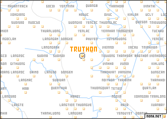
Trù Thôn (Vietnam)Trù Thôn is a town in Vietnam. An overview map of the region around Trù Thôn is displayed below.
regional and 3d topo map of Trù Thôn, Vietnam ::
Trù Thôn airports ::
The nearest airport is HAN - Hanoi Noibai Intl, located 51.9 km north of Trù Thôn.
Nearby towns ::
Tuy Lai (0.0km north) //
Thượng Thôn (1.9km north) //
Cầu Thôn (1.9km north) //
Vĩnh Lạc (1.7km east) //
Lai Tảo (2.5km north east) //
Vĩnh Lộc Thương (2.5km south east) //
Chân Chim (4.1km north east) //
Nga Ba Tha (4.1km north east) //
Phù Yên (4.1km north east) //
Mỹ Tiên (3.9km north east) //
Cống Khê Sở (4.1km south east) //
Tảo Khê (3.9km south east) //
Ðong Kế (5.1km north west) //
Ðồng Em (5.1km south west) //
Tử Dương (5.2km east) //
Suối Sôi (5.2km west) //
Guối Bồ (5.2km west) //
Bột Xuyên (5.2km east) //
Yên Lạc (5.6km north) //
Ðương Mit (5.6km north) //
Viên Nội (5.5km east) //
Ao Kênh (5.5km west) //
Thượng Lâm (5.8km north) //
Vĩnh Hạ (5.5km east) //
Ðồng Mai (6.4km north west) //
Thanh Áng (6.4km south east) //
Lê Xả (6.4km south east) //
Thành Vật (6.4km south east) //
Thiết Tháp (7.4km north) //
[all distances 'as the bird flies' and approximate]  Places with similar names to Trù Thôn, Vietnam ::
Disclaimer :: Information on this page comes without warranty of any kind |
||
|
Where is Trù Thôn? Elevation and coordinates ::
Latitude (lat): 20°46'0"N Longitude (lon): 105°41'0"E
Elevation (approx.): 10m (map arrows pan, magnifying glasses zoom) |
||
|
Visiting Trù Thôn? Hotel/Accommodation ::
Book a hotel in Trù Thôn Travel Guide ::
Buy a travel guide for Vietnam rental cars ::
car rental offers GPS waypoint ::
download a GPX waypoint (PoI) of Trù Thôn for your GPS receiver
|
||