|
search place name
|
||
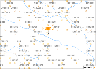
Xóm Mô (Vietnam)Xóm Mô is a town in Vietnam. An overview map of the region around Xóm Mô is displayed below.
regional and 3d topo map of Xóm Mô, Vietnam ::
Xóm Mô airports ::
The nearest airport is HAN - Hanoi Noibai Intl, located 101.1 km north east of Xóm Mô.
Nearby towns ::
Xóm Xương (0.0km north) //
Xóm Tieng (1.9km north) //
Xóm Ðôi Chuong (3.7km south) //
Làng Boi (3.7km north) //
Xóm Khải (3.5km west) //
Xóm Dy (4.1km south west) //
Làng Ðam (4.1km north east) //
Xóm Xot (3.9km north east) //
Xóm Chần (5.6km south) //
Xóm Biên (5.8km south) //
Làng Bai Nha (5.8km north) //
Xóm Ấm (5.5km west) //
Làng Mon (5.5km west) //
Xóm Kiến (6.4km south west) //
Làng Diên (6.6km north west) //
Xóm Sài (6.6km south east) //
Nội Sá (7.4km south) //
Xóm Phéo (7.4km north) //
Làng Troi (7.2km east) //
Làng Vo (7.6km north) //
Làng Chong (7.6km north east) //
Chí Gao (7.9km north west) //
Xóm Cã (8.2km south west) //
Ðịnh Cư (8.2km north east) //
Làng Hố (8.2km north east) //
Xóm Khu Thương (8.9km south east) //
Vũ Lao (8.9km north east) //
Làng Ben Bai (9.1km north west) //
Hương Lạc Sơn (9.5km north east) //
[all distances 'as the bird flies' and approximate]  Places with similar names to Xóm Mô, Vietnam ::
Disclaimer :: Information on this page comes without warranty of any kind |
||
|
Where is Xóm Mô? Elevation and coordinates ::
Latitude (lat): 20°24'0"N Longitude (lon): 105°23'0"E
Elevation (approx.): 376m (map arrows pan, magnifying glasses zoom) |
||
|
Visiting Xóm Mô? Hotel/Accommodation ::
Book a hotel in Xóm Mô Travel Guide ::
Buy a travel guide for Vietnam rental cars ::
car rental offers GPS waypoint ::
download a GPX waypoint (PoI) of Xóm Mô for your GPS receiver
|
||