|
search place name
|
||
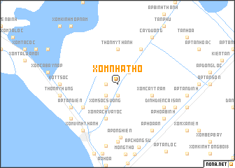
Xóm Nhà Thờ (Kiến Giang, Vietnam)Xóm Nhà Thờ is a town in the Kiến Giang region of Vietnam. An overview map of the region around Xóm Nhà Thờ is displayed below.
regional and 3d topo map of Xóm Nhà Thờ, Vietnam ::
Xóm Nhà Thờ airports ::
The nearest airport is PNH - Phnom-penh Phnom Penh Intl, located 164.9 km north of Xóm Nhà Thờ.
Other airports nearby include SGN - Ho Chi Minh City Tansonnhat Intl (185.1 km north east), Nearby towns ::
Ấp Giầy Heo (1.9km south) //
Ấp Khúc Cung (1.9km south) //
Ấp Tà Keo (1) (1.8km west) //
Ấp Tà Keo (2.6km south west) //
Ấp Phú Hội (2.6km north east) //
Xóm Sóc Suông (4.1km south west) //
Thôn Mỹ Thanh (5.6km north) //
Xóm Cây Tràm (5.8km east) //
Xóm Rạch Vây Ốc (5.9km south) //
Thôn Vĩnh Thông (5.9km south) //
Ấp Rạch Giồng (6.6km south west) //
Ấp Tân Lập (6.7km north east) //
Ấp Tân Ðiền (8.2km south west) //
Dinh Ðiền Cái Sắn (8.2km south east) //
Ấp Ông Hiền (8.6km south) //
Ấp Hòa An (9.2km south east) //
Rạch Giá (9.2km south west) //
Xóm Vĩnh Thanh (9.2km south west) //
Xóm Rạch Giồng (9.2km south west) //
Thôn Vĩnh Thanh (9.2km south west) //
Ấp Hòa Bình (9.2km south east) //
Cây Dương (9.2km north east) //
Ấp Tân Phú (9.2km north east) //
[all distances 'as the bird flies' and approximate]  Places with similar names to Xóm Nhà Thờ, Vietnam ::
Disclaimer :: Information on this page comes without warranty of any kind |
||
|
Where is Xóm Nhà Thờ? Elevation and coordinates ::
Latitude (lat): 10°5'0"N Longitude (lon): 105°8'0"E
Elevation (approx.): 4m (map arrows pan, magnifying glasses zoom) |
||
|
Visiting Xóm Nhà Thờ? Hotel/Accommodation ::
Book a hotel in Xóm Nhà Thờ Travel Guide ::
Buy a travel guide for Vietnam rental cars ::
car rental offers GPS waypoint ::
download a GPX waypoint (PoI) of Xóm Nhà Thờ for your GPS receiver
|
||