|
search place name
|
||
Xóm Rẫy (An Giang, Vietnam)Xóm Rẫy is a town in the An Giang region of Vietnam. An overview map of the region around Xóm Rẫy is displayed below.
regional and 3d topo map of Xóm Rẫy, Vietnam ::

Xóm Rẫy airports ::
The nearest airport is PNH - Phnom-penh Phnom Penh Intl, located 114.3 km north of Xóm Rẫy.
Other airports nearby include SGN - Ho Chi Minh City Tansonnhat Intl (178.1 km east), Nearby towns ::
Bà Khẹt (0.0km north) //
Phum Khvao (1.9km south) //
Phum Prom Chhuéa (1.9km south) //
Phum Prolai Méas (1.9km south) //
Phum Trapéang Prêy (1.9km north) //
Tà Móc (2.6km north west) //
Phum Chenn (4.1km north west) //
Mần Rò (5.2km north west) //
Phum Cần Chai Krom (5.6km south) //
Xoài Chết (5.8km west) //
Phum Banteai Dek (5.9km south) //
Phum Krang Chai (5.9km south) //
Sóc Gù (6.6km north west) //
Phum Si Túp (7.5km west) //
Hồ Ðá (7.6km north) //
Sốc Cup Ðe (8.3km south west) //
Sốc Sây Ðu (8.3km south west) //
Ngã Ba Lâm Giồ (8.3km north west) //
Phum Chưng Rung (8.2km north west) //
[all distances 'as the bird flies' and approximate] 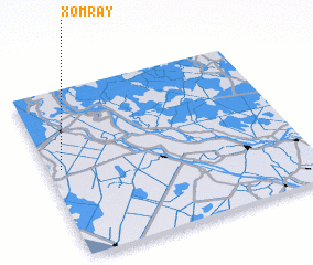 Places with similar names to Xóm Rẫy, Vietnam ::
Disclaimer :: Information on this page comes without warranty of any kind |
||
|
Where is Xóm Rẫy? Elevation and coordinates ::
Latitude (lat): 10°32'0"N Longitude (lon): 105°3'0"E
Elevation (approx.): 3m (map arrows pan, magnifying glasses zoom) |
||
|
Visiting Xóm Rẫy? Hotel/Accommodation ::
Book a hotel in Xóm Rẫy Travel Guide ::
Buy a travel guide for Vietnam rental cars ::
car rental offers GPS waypoint ::
download a GPX waypoint (PoI) of Xóm Rẫy for your GPS receiver
|
||