|
search place name
|
||
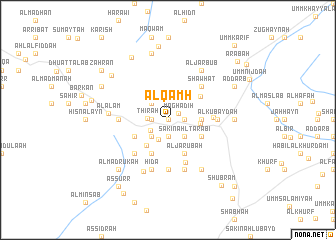
Al Qamḩ (‘Adan, Yemen)Al Qamḩ is a town in the ‘Adan region of Yemen. An overview map of the region around Al Qamḩ is displayed below.
regional and 3d topo map of Al Qamḩ, Yemen ::
Nearby towns ::
Bayt Badaḩīl (0.0km north) //
Al Mirşāş (0.0km north) //
Maghādiḩ (1.3km north east) //
Sākin al Wādī (1.9km south) //
Al Jinḩ (1.8km east) //
Widn Dhahr (1.8km east) //
Badhai (1.8km east) //
Sākin al Maḩrūq (1.8km west) //
Thirah (2.2km west) //
Umm Sha‘rah (2.3km north) //
Umm Mishqālah (2.3km south west) //
Sākin Hazm (2.4km south west) //
Sākin Ahl Ţarābī (2.6km south east) //
Al Mirşāş (2.6km south west) //
Mukaymah as Suflá (2.6km north west) //
Umm Qā‘ (3.6km south west) //
Zārah (3.6km east) //
Al Ḩabīl (3.6km east) //
Mukaymah (3.6km east) //
Al Ḩamrāʼ (3.6km east) //
Al Jarūbah (4.1km south east) //
Aţ Ţarīyah (4.0km south east) //
Aş Şawma‘ah (4.1km south west) //
Ahl Juḩayf (4.0km south west) //
Umm Na‘būb (4.4km north east) //
Jawf Umm Maqbābah (5.1km south) //
Lawdar (5.0km east) //
Sākin Ahl as Sayyid (5.2km south west) //
Shawḩaţ (5.2km north east) //
[all distances 'as the bird flies' and approximate]  Places with similar names to Al Qamḩ, Yemen ::
Disclaimer :: Information on this page comes without warranty of any kind |
||
|
Where is Al Qamḩ? Elevation and coordinates ::
Latitude (lat): 13°53'0"N Longitude (lon): 45°49'0"E
Elevation (approx.): 1112m (map arrows pan, magnifying glasses zoom) |
||
|
Visiting Al Qamḩ? Hotel/Accommodation ::
Book a hotel in Al Qamḩ Travel Guide ::
Buy a travel guide for Yemen rental cars ::
car rental offers GPS waypoint ::
download a GPX waypoint (PoI) of Al Qamḩ for your GPS receiver
|
||