|
search place name
|
||
Ḩişn Hamā (‘Adan, Yemen)Ḩişn Hamā is a town in the ‘Adan region of Yemen. An overview map of the region around Ḩişn Hamā is displayed below.
regional and 3d topo map of Ḩişn Hamā, Yemen ::

Ḩişn Hamā airports ::
The nearest airport is SHW - Sharurah, located 209.8 km north west of Ḩişn Hamā.
Nearby towns ::
Ḩişn Bin Ja‘bayn (5.3km east) //
Ḩişn Bin ‘Amūrī (5.3km east) //
Ḩayd Bin Haytham (5.3km east) //
Al Marāfiz (5.6km east) //
Jizal Bin Quwayyir (7.3km east) //
Al Ḩanw (7.6km north) //
Ḩişn al ‘Amūrī (7.7km north east) //
Ḩişn al Fara‘ (7.7km north east) //
Al Maşna‘ah (8.0km south west) //
Ḩayd Bin Haytham (8.0km north east) //
Ḩişn Bin ‘Assālah (9.0km north east) //
Ḩişn Bin Qasā (9.1km north east) //
Z̧ālim (10.3km south west) //
[all distances 'as the bird flies' and approximate] 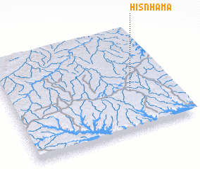 Places with similar names to Ḩişn Hamā, Yemen ::
Disclaimer :: Information on this page comes without warranty of any kind |
||
|
Where is Ḩişn Hamā? Elevation and coordinates ::
Latitude (lat): 16°24'0"N Longitude (lon): 48°45'0"E
Elevation (approx.): 1096m (map arrows pan, magnifying glasses zoom) |
||
|
Visiting Ḩişn Hamā? Hotel/Accommodation ::
Book a hotel in Ḩişn Hamā Travel Guide ::
Buy a travel guide for Yemen rental cars ::
car rental offers GPS waypoint ::
download a GPX waypoint (PoI) of Ḩişn Hamā for your GPS receiver
|
||