|
search place name
|
||
Chung-ho-ts'un (T'ai-wan, Taiwan)Chung-ho-ts'un is a town in the T'ai-wan region of Taiwan. An overview map of the region around Chung-ho-ts'un is displayed below.
regional and 3d topo map of Chung-ho-ts'un, Taiwan ::

Chung-ho-ts'un airports ::
The nearest airport is PIF - Pingtung South, located 14.3 km south of Chung-ho-ts'un.
Other airports nearby include KHH - Kaohsiung Intl (28.2 km south west), TNN - Tainan (33.0 km north west), TTT - Fengnin (63.7 km east), CYI - Chiayi (73.9 km north), Nearby towns ::
K'o-nan-hsin-ts'un (0.0km north) //
Hsi-lung (1.9km north) //
Kuo-kang-tzu (1.9km south) //
Cho-chia (1.7km east) //
Pu-hou (1.9km south) //
Hsia-tu (2.5km north west) //
T'u-k'u (2.5km north east) //
Chung-wan-chia (2.5km north east) //
Nan-hsing (2.5km north east) //
Ch'ieh-tung-chiao (2.5km south east) //
Fu-hsing (2.5km south east) //
T'ieh-tien (2.5km south east) //
Mi-li (2.6km north) //
Li-kang (2.8km south) //
Shang-ho (2.9km north west) //
Nan-sheng-hu (3.4km west) //
Ch'i-lao (3.7km south) //
Ch'i-tzu-t'ou (3.7km south) //
Ch'ao-chou (4.1km south west) //
Kuang-ming (4.1km south west) //
T'a-lou (4.1km south west) //
Lung-wen (3.9km south west) //
Chu-chi (4.1km north east) //
Lin-tzu (4.1km south east) //
Feng-p'ing (4.1km south east) //
Wu-lo (4.1km south east) //
Ya-mu-liao (4.1km south east) //
Ting-fan-she (4.1km south east) //
Chung-fan-she (4.1km south east) //
[all distances 'as the bird flies' and approximate] 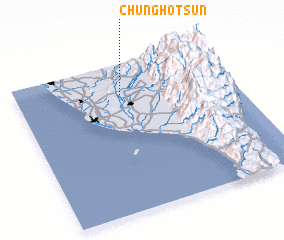 Places with similar names to Chung-ho-ts'un, Taiwan ::
// Chandesīn (IR)
// Chandsain (IN)
// Ch'in-ai-ts'un (TW)
// Chung-ho-ts'un (TW)
// Chung-ho-ts'un (TW)
// Chung-ho-ts'un (TW)
// Hsi-an-ts'un (TW)
// Shan-ts'un (TW)
// Shuang-hu-ts'un (TW)
// Shui-an-ts'un (TW)
Disclaimer :: Information on this page comes without warranty of any kind |
||
|
Where is Chung-ho-ts'un? Elevation and coordinates ::
Latitude (lat): 22°48'0"N Longitude (lon): 120°29'0"E
Elevation (approx.): 45m (map arrows pan, magnifying glasses zoom) |
||
|
Visiting Chung-ho-ts'un? Hotel/Accommodation ::
Book a hotel in Chung-ho-ts'un Travel Guide ::
Buy a travel guide for Taiwan rental cars ::
car rental offers GPS waypoint ::
download a GPX waypoint (PoI) of Chung-ho-ts'un for your GPS receiver
|
||