|
search place name
|
||
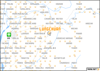
Lung-ch'üan (T'ai-wan, Taiwan)Lung-ch'üan is a town in the T'ai-wan region of Taiwan. An overview map of the region around Lung-ch'üan is displayed below.
regional and 3d topo map of Lung-ch'üan, Taiwan ::
Lung-ch'üan airports ::
The nearest airport is PIF - Pingtung South, located 14.2 km west of Lung-ch'üan.
Other airports nearby include KHH - Kaohsiung Intl (27.6 km west), TNN - Tainan (51.0 km north west), TTT - Fengnin (52.4 km east), GNI - Green Island Lyudao (89.1 km east), Nearby towns ::
Shang-chuang (1.5km north) //
Li-ming (1.5km north) //
Tu-chün-ying (1.7km west) //
Shang-ta-hsin (1.7km west) //
Ta-pu (2.2km south) //
Chung-lin (2.2km south) //
Jen-ai-hsin-ts'un (2.3km north west) //
Tung-p'ien-ts'un (2.8km south west) //
Ching-hsing (2.8km south west) //
Chung-ts'un (3.4km north) //
Mei-yüan (3.4km north) //
Hsia-ta-hsin (3.4km west) //
Jih-hsin-ts'un (3.8km north west) //
Hsia-ai-liao (3.8km north east) //
Hsin-i-hsin-ts'un (3.7km north west) //
Shih-chien-hsin-ts'un (3.7km north west) //
Ma-chia (3.8km north east) //
Lao-p'i (4.0km south) //
Ta-ho (4.0km south west) //
Chia-i-ts'un (4.1km south east) //
Hsin-nan-ts'un (4.4km south west) //
Fan-tzu-liao (4.5km north west) //
Yai-liao (4.8km north east) //
Liang-shan-ts'un (4.8km north east) //
Chiu-ai-liao (5.2km north) //
Chin-lung-ts'un (5.2km north) //
Tsao-tzu-chiao (5.3km south west) //
Hsin-tung-shih (5.3km south west) //
Ho-p'ing-hsin-ts'un (5.1km west) //
[all distances 'as the bird flies' and approximate] 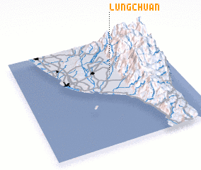 Places with similar names to Lung-ch'üan, Taiwan ::
// Langatian (PH)
// Lung Chen (BT)
// Langutiān (IN)
// Lungtian (IN)
// Langshan (CN)
// Liangtian (CN)
// Longtian (CN)
// Lung-shan (TW)
// Langasi-an (PH)
// Lung-ch'üan (TW)
Disclaimer :: Information on this page comes without warranty of any kind |
||
|
Where is Lung-ch'üan? Elevation and coordinates ::
Latitude (lat): 22°40'11"N Longitude (lon): 120°35'59"E
Elevation (approx.): 61m (map arrows pan, magnifying glasses zoom) |
||
|
Visiting Lung-ch'üan? Hotel/Accommodation ::
Book a hotel in Lung-ch'üan Travel Guide ::
Buy a travel guide for Taiwan rental cars ::
car rental offers GPS waypoint ::
download a GPX waypoint (PoI) of Lung-ch'üan for your GPS receiver
|
||