|
search place name
|
||
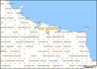
Wu-liu-k'eng (T'ai-wan, Taiwan)Wu-liu-k'eng is a town in the T'ai-wan region of Taiwan. An overview map of the region around Wu-liu-k'eng is displayed below.
regional and 3d topo map of Wu-liu-k'eng, Taiwan ::
Wu-liu-k'eng airports ::
The nearest airport is TSA - Taipei Sungshan, located 23.9 km west of Wu-liu-k'eng.
Other airports nearby include TPE - Taipei Chiang Kai Shek Intl (55.7 km west), HUN - Hualien (122.3 km south), OGN - Yonaguni Jima Yonaguni (140.6 km south east), MZW - Matsu Beigan (216.8 km north west), Nearby towns ::
Kuan-yü-k'eng (0.0km north) //
Liu-k'eng (0.0km north) //
K'ang-k'ou (0.0km north) //
Ssu-chiao-t'ing-k'eng (1.7km west) //
Chiao-t'ing (1.7km west) //
Hsiao-kang-li (1.9km north) //
Shen-ao-k'eng (1.9km north) //
Sha-tzu-yüan (1.9km north) //
Ch'i-k'eng (1.9km south) //
Jui-an (1.9km south) //
K'ang-nei (1.9km south) //
Ting-p'ing (1.9km south) //
Lung-t'an-tu (1.7km east) //
Jui-fang (1.7km east) //
Lan-t'ou-kou (2.5km north west) //
Ch'uang-ling-chuang (2.5km north west) //
Ch'uang-ling (2.5km north west) //
Kang-tzu-liao (2.5km north west) //
Yüan-ch'uang-k'eng (2.5km north west) //
Feng-tzu-lai (2.5km south west) //
Tu-ch'uan-t'ou-pu (2.5km south west) //
Ta-liao (2.5km south west) //
Ti-shui-shan (2.5km south west) //
Shen-ao-shan-chiao (2.5km north east) //
Shen-ao (2.5km north east) //
Ch'ang-t'an-li (2.5km north east) //
Shu-shih (2.5km south east) //
San-k'ang (2.5km south east) //
Ta-k'eng-nei (3.4km west) //
[all distances 'as the bird flies' and approximate] 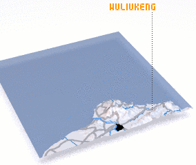 Places with similar names to Wu-liu-k'eng, Taiwan ::
// Walking (DE)
// Wŏlgang (KP)
// Wu-lao-k'eng (TW)
// Wielkanoc (PL)
// Walakawng (MM)
// Walakawng (MM)
// Wulawkawng (MM)
// Wuligang (CN)
// Wuligang (CN)
Disclaimer :: Information on this page comes without warranty of any kind |
||
|
Where is Wu-liu-k'eng? Elevation and coordinates ::
Latitude (lat): 25°7'0"N Longitude (lon): 121°47'0"E
Elevation (approx.): 181m (map arrows pan, magnifying glasses zoom) |
||
|
Visiting Wu-liu-k'eng? Hotel/Accommodation ::
Book a hotel in Wu-liu-k'eng Travel Guide ::
Buy a travel guide for Taiwan rental cars ::
car rental offers GPS waypoint ::
download a GPX waypoint (PoI) of Wu-liu-k'eng for your GPS receiver
|
||