|
search place name
|
||
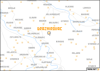
Dražmirovac (Srbija, Serbia and Montenegro)Dražmirovac is a town in the Srbija region of Serbia and Montenegro. An overview map of the region around Dražmirovac is displayed below.
regional and 3d topo map of Dražmirovac, Serbia and Montenegro ::
Dražmirovac airports ::
The nearest airport is INI - Nis, located 89.6 km south east of Dražmirovac.
Other airports nearby include BEG - Beograd (118.4 km north west), PRN - Pristina (166.7 km south), CSB - Caransebes (167.7 km north east), TSR - Timisoara Traian Vuia (194.9 km north), Nearby towns ::
Glogovac (3.1km south west) //
Balajnac (3.9km north) //
Trućevac (3.5km north east) //
Krušar (4.2km south) //
Bogava (4.7km north west) //
Isakovo (4.5km south east) //
Mali Popović (4.3km west) //
Veliki Popović (6.9km north) //
Brestovo (6.9km north) //
Vitance (5.9km north east) //
Vlaška (7.7km south) //
Duboka (6.1km west) //
Virine (6.3km south east) //
Dobra Voda (7.2km north west) //
Gladna (7.2km north west) //
Kočino Selo (6.4km south west) //
Ribare (7.5km south west) //
Supska (9.0km south) //
Rakitovo (8.3km south west) //
Miliva (10.3km north east) //
[all distances 'as the bird flies' and approximate]  Places with similar names to Dražmirovac, Serbia and Montenegro :: Disclaimer :: Information on this page comes without warranty of any kind |
||
|
Where is Dražmirovac? Elevation and coordinates ::
Latitude (lat): 44°3'21"N Longitude (lon): 21°20'54"E
Elevation (approx.): 168m (map arrows pan, magnifying glasses zoom) |
||
|
Visiting Dražmirovac? Hotel/Accommodation ::
Book a hotel in Dražmirovac Travel Guide ::
rental cars ::
car rental offers GPS waypoint ::
download a GPX waypoint (PoI) of Dražmirovac for your GPS receiver
|
||