|
search place name
|
||
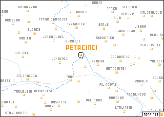
Petačinci (Srbija, Serbia and Montenegro)Petačinci is a town in the Srbija region of Serbia and Montenegro. An overview map of the region around Petačinci is displayed below.
regional and 3d topo map of Petačinci, Serbia and Montenegro ::
Petačinci airports ::
The nearest airport is SOF - Sofia, located 63.3 km east of Petačinci.
Other airports nearby include INI - Nis (83.9 km north west), SKP - Skopje (133.9 km south west), PRN - Pristina (138.5 km west), CRA - Craiova (187.5 km north east), Nearby towns ::
Bankya (1.9km south) //
Vrapča (1.8km north east) //
Iskrovci (3.5km north west) //
Vrabcha (3.0km south east) //
Lomnitsa (3.8km west) //
Bogoina (5.2km south) //
Trŭn (5.3km south) //
Skrvenica (5.5km north east) //
Dragovita (7.1km north) //
Jasenov Del (6.3km north west) //
Ezdimirtsi (7.6km south) //
Gornja Nevlja (6.3km north east) //
Butrointsi (6.5km south east) //
Barje (7.8km north east) //
Prodancha (6.4km east) //
Filipovtsi (8.2km south east) //
Cirinci (8.2km north west) //
Turokovtsi (8.3km south west) //
Trnski Odorovci (9.5km north west) //
Mraketintsi (9.4km south east) //
Bilo (10.3km north east) //
Berayntsi (10.4km south west) //
[all distances 'as the bird flies' and approximate] 
Disclaimer :: Information on this page comes without warranty of any kind |
||
|
Where is Petačinci? Elevation and coordinates ::
Latitude (lat): 42°52'48"N Longitude (lon): 22°40'28"E
Elevation (approx.): 646m (map arrows pan, magnifying glasses zoom) |
||
|
Visiting Petačinci? Hotel/Accommodation ::
Book a hotel in Petačinci Travel Guide ::
rental cars ::
car rental offers GPS waypoint ::
download a GPX waypoint (PoI) of Petačinci for your GPS receiver
|
||