|
search place name
|
||
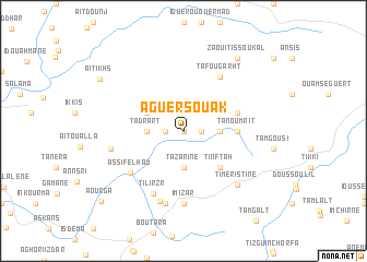
Aguer Souak (Agadir, Morocco)Aguer Souak is a town in the Agadir region of Morocco. An overview map of the region around Aguer Souak is displayed below.
regional and 3d topo map of Aguer Souak, Morocco ::
Aguer Souak airports ::
The nearest airport is AGA - Agadir Inezgane, located 45.9 km south of Aguer Souak.
Other airports nearby include RAK - Marrakech Menara (161.4 km north east), Nearby towns ::
Iguenarene (NaNkm north) //
Beni Yahia (1.6km east) //
Iggui nʼTama (1.6km east) //
Anzouka (1.6km west) //
Tachaoukecht (3.2km east) //
Tazarine (3.7km south) //
Tadrart (3.2km west) //
Zntou (3.7km north west) //
Tinftah (4.9km south east) //
Tanoumrit (4.8km east) //
Iguer Bou Ahmed (5.1km east) //
Tafougarht (6.4km north east) //
Assif el Had (6.3km south west) //
Tilirzr (6.9km south) //
Imizar (7.4km south) //
Tilirzr (7.5km south) //
Iggui Ifri (7.6km south) //
Tighijjout (6.6km west) //
Timeristine (7.3km south east) //
Zaouit Issoukal (8.8km north east) //
Aït Ikhs (9.0km north west) //
Aourga (10.2km south west) //
[all distances 'as the bird flies' and approximate] 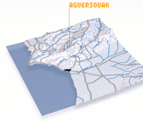 Places with similar names to Aguer Souak, Morocco ::
// Aguerzga (MA)
// Aguerzga (MA)
// Ak-Kara-Sug (RU)
// Aygurskiy (RU)
// Aguerzaka (MA)
// Agriosikéa (GR)
// Agrosikéai (GR)
// Agrosykéa (GR)
Disclaimer :: Information on this page comes without warranty of any kind |
||
|
Where is Aguer Souak? Elevation and coordinates ::
Latitude (lat): 30°47'0"N Longitude (lon): 9°26'0"W
Elevation (approx.): 951m (map arrows pan, magnifying glasses zoom) |
||
|
Visiting Aguer Souak? Hotel/Accommodation ::
Book a hotel in Aguer Souak Travel Guide ::
Buy a travel guide for Morocco rental cars ::
car rental offers GPS waypoint ::
download a GPX waypoint (PoI) of Aguer Souak for your GPS receiver
|
||