|
search place name
|
||
Aït Ali Ou Hammou (Taroudannt, Morocco)Aït Ali Ou Hammou is a town in the Taroudannt region of Morocco. An overview map of the region around Aït Ali Ou Hammou is displayed below.
regional and 3d topo map of Aït Ali Ou Hammou, Morocco ::

Aït Ali Ou Hammou airports ::
The nearest airport is RAK - Marrakech Menara, located 83.3 km north of Aït Ali Ou Hammou.
Other airports nearby include OZZ - Ouarzazate (85.4 km east), AGA - Agadir Inezgane (176.4 km west), Nearby towns ::
Tizgui (0.0km north) //
Tizgui nʼ Aït Mekkor (1.9km north) //
Mansour (1.6km west) //
Amazzer (2.4km south west) //
Timiguedal (2.4km south west) //
Aguerd nʼ Ouzarhar (4.0km south west) //
Igoumrane (5.8km south) //
Tarhiroucht (6.4km south west) //
Arabene (6.4km south east) //
Tissert (6.4km north west) //
Anemid (7.4km north) //
Tamjercht (7.6km south) //
Igourzane (7.6km south) //
Illoukoussene (7.3km south west) //
Ilemsane (8.1km south west) //
Taourirt nʼAït Mesri (8.8km south west) //
Tizourhine (8.8km north west) //
Irhil (8.8km north west) //
Imoukhsane (8.4km north west) //
Akochtim (9.8km south east) //
[all distances 'as the bird flies' and approximate] 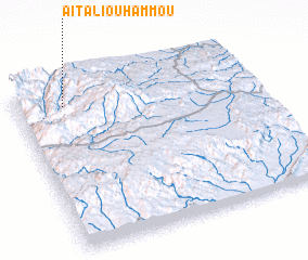 Places with similar names to Aït Ali Ou Hammou, Morocco ::
// Adelheim (DE)
// Aït el Hami (MA)
Disclaimer :: Information on this page comes without warranty of any kind |
||
|
Where is Aït Ali Ou Hammou? Elevation and coordinates ::
Latitude (lat): 30°53'0"N Longitude (lon): 7°48'0"W
Elevation (approx.): 1945m (map arrows pan, magnifying glasses zoom) |
||
|
Visiting Aït Ali Ou Hammou? Hotel/Accommodation ::
Book a hotel in Aït Ali Ou Hammou Travel Guide ::
Buy a travel guide for Morocco rental cars ::
car rental offers GPS waypoint ::
download a GPX waypoint (PoI) of Aït Ali Ou Hammou for your GPS receiver
|
||