|
search place name
|
||
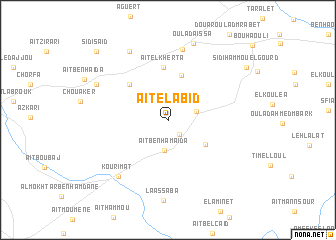
Aït el Abid (Essaouira, Morocco)Aït el Abid is a town in the Essaouira region of Morocco. An overview map of the region around Aït el Abid is displayed below.
regional and 3d topo map of Aït el Abid, Morocco ::
Aït el Abid airports ::
The nearest airport is RAK - Marrakech Menara, located 116.8 km east of Aït el Abid.
Other airports nearby include AGA - Agadir Inezgane (128.5 km south), CMN - Casablanca Mohammed V Intl (258.7 km north east), Nearby towns ::
El Gramta (2.0km south east) //
Zaouiat Timesket (2.9km east) //
Aït Ben Hamaïda (3.4km south) //
Oulad Mbark (4.5km south east) //
Aït Omar Bel Layachi (5.2km north) //
Dar Aït Mansour (5.4km north west) //
Aït el Kherta (5.8km north) //
Souk Tafetecht (8.0km north) //
Kourimat (7.9km south west) //
Dar Ben Fatna (8.5km north west) //
Dar Sidi Raoui (7.9km north west) //
Aït Bel Fejjaj (7.9km north west) //
Oulad Aïssa (8.9km north) //
Sidi Hammou el Gourd (9.4km north east) //
Sidi Saïd (10.2km north west) //
[all distances 'as the bird flies' and approximate]  Places with similar names to Aït el Abid, Morocco ::
Disclaimer :: Information on this page comes without warranty of any kind |
||
|
Where is Aït el Abid? Elevation and coordinates ::
Latitude (lat): 31°30'52"N Longitude (lon): 9°15'42"W
Elevation (approx.): 525m (map arrows pan, magnifying glasses zoom) |
||
|
Visiting Aït el Abid? Hotel/Accommodation ::
Book a hotel in Aït el Abid Travel Guide ::
Buy a travel guide for Morocco rental cars ::
car rental offers GPS waypoint ::
download a GPX waypoint (PoI) of Aït el Abid for your GPS receiver
|
||