|
search place name
|
||
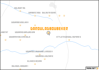
Dar Oulad Bou Beker (Settat, Morocco)Dar Oulad Bou Beker is a town in the Settat region of Morocco. An overview map of the region around Dar Oulad Bou Beker is displayed below.
regional and 3d topo map of Dar Oulad Bou Beker, Morocco ::
Dar Oulad Bou Beker airports ::
The nearest airport is CMN - Casablanca Mohammed V Intl, located 68.1 km north west of Dar Oulad Bou Beker.
Other airports nearby include RBA - Rabat Sale (145.1 km north), RAK - Marrakech Menara (152.5 km south west), NNA - Kentira Kenitra (175.8 km north), MEK - Meknes Bassatine (201.2 km north east), Nearby towns ::
Douar Driss (6.0km north west) //
Oulad Yassine (7.4km north) //
Et Tleta des Oulad Fares (6.5km east) //
Douar Oulad el Graïni (8.0km north east) //
Douar Oulad Sidi Belkassem (8.0km south west) //
Douar el Yssouf (8.8km north east) //
Dar Ben Zaou (8.8km north west) //
[all distances 'as the bird flies' and approximate] 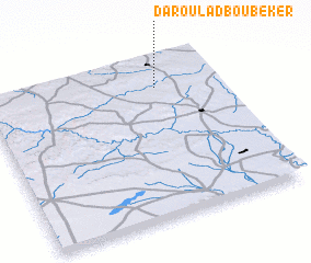 Places with similar names to Dar Oulad Bou Beker, Morocco ::
// Douar Oulad Bou Beker (MA)
Disclaimer :: Information on this page comes without warranty of any kind |
||
|
Where is Dar Oulad Bou Beker? Elevation and coordinates ::
Latitude (lat): 32°49'0"N Longitude (lon): 7°16'0"W
Elevation (approx.): 665m (map arrows pan, magnifying glasses zoom) |
||
|
Visiting Dar Oulad Bou Beker? Hotel/Accommodation ::
Book a hotel in Dar Oulad Bou Beker Travel Guide ::
Buy a travel guide for Morocco rental cars ::
car rental offers GPS waypoint ::
download a GPX waypoint (PoI) of Dar Oulad Bou Beker for your GPS receiver
|
||