|
search place name
|
||
El Hajajma (Sidi Kacem, Morocco)El Hajajma is a town in the Sidi Kacem region of Morocco. An overview map of the region around El Hajajma is displayed below.
regional and 3d topo map of El Hajajma, Morocco ::

El Hajajma airports ::
The nearest airport is MEK - Meknes Bassatine, located 83.8 km south of El Hajajma.
Other airports nearby include FEZ - Fez Saiss (95.3 km south east), NNA - Kentira Kenitra (101.6 km west), TTU - Tetouan Saniat Rmel (109.0 km north), TNG - Tanger Ibn Batouta (125.4 km north), Nearby towns ::
Aouifat (1.9km south) //
Jemiâïne (2.4km north west) //
Beni Sennana (3.7km south) //
Douar Oulad Salem (3.0km west) //
Khobziine (4.0km south) //
El Ararsa (4.8km north west) //
El Haricha (5.6km south) //
Douar Chaouia (4.9km west) //
Aïn Defali (5.8km south) //
El Bour (4.9km west) //
Chouaker (4.9km west) //
Douar Chaouiat Rmel (5.9km south west) //
El Klaa (6.1km east) //
Douar Beni Mohammed (6.4km west) //
Zouriyine (7.6km north) //
Es Sbaïne (6.4km east) //
Doukkane (8.0km south) //
Douar Chaouia (8.0km north) //
Tamaloust (7.1km north east) //
Oulad Noual (8.3km south east) //
Douar Lahouari (8.7km north east) //
Es Setine (9.6km south west) //
Ziana (9.6km south west) //
[all distances 'as the bird flies' and approximate] 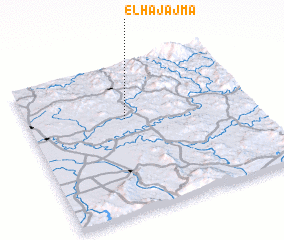 Places with similar names to El Hajajma, Morocco :: Disclaimer :: Information on this page comes without warranty of any kind |
||
|
Where is El Hajajma? Elevation and coordinates ::
Latitude (lat): 34°38'0"N Longitude (lon): 5°34'0"W
Elevation (approx.): 130m (map arrows pan, magnifying glasses zoom) |
||
|
Visiting El Hajajma? Hotel/Accommodation ::
Book a hotel in El Hajajma Travel Guide ::
Buy a travel guide for Morocco rental cars ::
car rental offers GPS waypoint ::
download a GPX waypoint (PoI) of El Hajajma for your GPS receiver
|
||