|
search place name
|
||
Foum el Anser (Beni Mellal, Morocco)Foum el Anser is a town in the Beni Mellal region of Morocco. An overview map of the region around Foum el Anser is displayed below.
regional and 3d topo map of Foum el Anser, Morocco ::

Foum el Anser airports ::
The nearest airport is CMN - Casablanca Mohammed V Intl, located 167.5 km north west of Foum el Anser.
Other airports nearby include OZZ - Ouarzazate (170.2 km south), ERH - Er-rachidia Moulay Ali Cherif (180.7 km east), MEK - Meknes Bassatine (181.2 km north), RAK - Marrakech Menara (188.7 km south west), Nearby towns ::
Hal Sabek (1.6km west) //
Aït Hammou Saïd (3.1km west) //
Sidi Mohammed el Atchane (3.6km north west) //
Adouz (3.6km south west) //
Tiloua nʼAït Daoud (3.6km south east) //
Ertmata (4.9km north east) //
Ksar et Tlatia (5.8km north) //
Aït Habibi (6.4km north east) //
Douar Messaoud (7.3km north east) //
Irhelrher (8.0km south east) //
Amchat (8.8km north east) //
[all distances 'as the bird flies' and approximate] 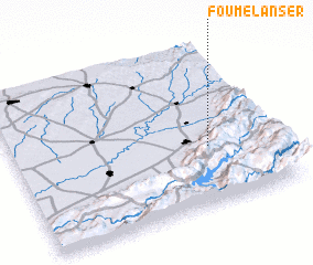 Places with similar names to Foum el Anser, Morocco :: Disclaimer :: Information on this page comes without warranty of any kind |
||
|
Where is Foum el Anser? Elevation and coordinates ::
Latitude (lat): 32°22'0"N Longitude (lon): 6°15'0"W
Elevation (approx.): 903m (map arrows pan, magnifying glasses zoom) |
||
|
Visiting Foum el Anser? Hotel/Accommodation ::
Book a hotel in Foum el Anser Travel Guide ::
Buy a travel guide for Morocco rental cars ::
car rental offers GPS waypoint ::
download a GPX waypoint (PoI) of Foum el Anser for your GPS receiver
|
||