|
search place name
|
||
Irhil nʼEd Baha (Agadir, Morocco)Irhil nʼEd Baha is a town in the Agadir region of Morocco. An overview map of the region around Irhil nʼEd Baha is displayed below.
regional and 3d topo map of Irhil nʼEd Baha, Morocco ::

Irhil nʼEd Baha airports ::
The nearest airport is AGA - Agadir Inezgane, located 48.0 km south of Irhil nʼEd Baha.
Other airports nearby include RAK - Marrakech Menara (185.7 km north east), Nearby towns ::
Sidi Bou Tlila (NaNkm north) //
Ibouchalloutn (3.1km north east) //
Er Riad (3.2km north west) //
Tiguemmi nʼFach (4.0km north west) //
Sidi el Haj Ahmed (3.7km north west) //
Akerkaou (4.5km south) //
Tibbinndout (4.8km south west) //
Ougar (4.9km south east) //
Assaka (5.1km north west) //
Tagayout (5.1km north west) //
Afra (4.9km west) //
Tanzart (5.1km east) //
Aït Aïssa (5.1km west) //
Tassila (5.1km west) //
Aït Ouchchane (5.5km south west) //
Takhsmout (6.6km north) //
Idou Hou (5.8km east) //
Id Hammou (7.1km north) //
Aït Oukkane (6.1km west) //
Aït Khemis (6.5km south east) //
Imzi (6.5km west) //
Liguemmi Ou Aers (7.6km south) //
Tikiouine (7.8km south) //
Tafroukht (6.7km east) //
Tafza (7.3km north east) //
Toufsirine (8.3km south east) //
Tagant Imsouane (7.9km north west) //
Tildi (7.6km north west) //
Timassinine (8.1km south west) //
[all distances 'as the bird flies' and approximate] 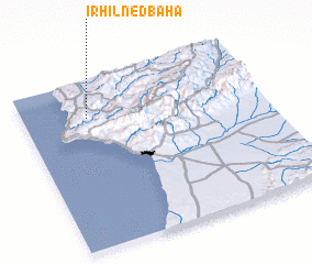 Places with similar names to Irhil nʼEd Baha, Morocco :: Disclaimer :: Information on this page comes without warranty of any kind |
||
|
Where is Irhil nʼEd Baha? Elevation and coordinates ::
Latitude (lat): 30°47'0"N Longitude (lon): 9°44'0"W
Elevation (approx.): 273m (map arrows pan, magnifying glasses zoom) |
||
|
Visiting Irhil nʼEd Baha? Hotel/Accommodation ::
Book a hotel in Irhil nʼEd Baha Travel Guide ::
Buy a travel guide for Morocco rental cars ::
car rental offers GPS waypoint ::
download a GPX waypoint (PoI) of Irhil nʼEd Baha for your GPS receiver
|
||