|
search place name
|
||
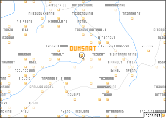
Oumsnât (Tata, Morocco)Oumsnât is a town in the Tata region of Morocco. An overview map of the region around Oumsnât is displayed below.
regional and 3d topo map of Oumsnât, Morocco ::
Oumsnât airports ::
The nearest airport is AGA - Agadir Inezgane, located 90.2 km north west of Oumsnât.
Other airports nearby include RAK - Marrakech Menara (221.4 km north east), Nearby towns ::
Tamalout (0.0km north) //
Agouchtim (1.6km east) //
Anebdour (2.5km south east) //
Taddart (2.5km south west) //
Tizekht (3.2km east) //
Talemast (4.0km north east) //
Imi nʼ Tanout (4.9km north east) //
Tagmout (5.6km north) //
Tandilt (4.8km west) //
Tarhzout (5.8km south) //
Tagmoût nʼ Aït Paout (5.8km north) //
Inejjarene (5.8km north) //
Tasga nʼToudma (5.2km west) //
Imi nʼTanout (6.1km north east) //
Imiane (6.4km south west) //
Agtel (7.4km north) //
Dimlalene (6.4km west) //
Taourirt Ouazzal (6.7km east) //
Tifrhelt (6.7km east) //
Tazarine (7.4km south east) //
Idikel (7.4km south east) //
Aguerd nʼDoudad (8.1km south west) //
Ikhoullane (8.8km north west) //
Amarkhsine (8.8km south east) //
Tafraout (8.5km south west) //
[all distances 'as the bird flies' and approximate] 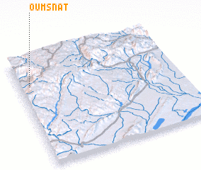 Places with similar names to Oumsnât, Morocco ::
// Omisende (CD)
Disclaimer :: Information on this page comes without warranty of any kind |
||
|
Where is Oumsnât? Elevation and coordinates ::
Latitude (lat): 29°46'0"N Longitude (lon): 8°56'0"W
Elevation (approx.): 1349m (map arrows pan, magnifying glasses zoom) |
||
|
Visiting Oumsnât? Hotel/Accommodation ::
Book a hotel in Oumsnât Travel Guide ::
Buy a travel guide for Morocco rental cars ::
car rental offers GPS waypoint ::
download a GPX waypoint (PoI) of Oumsnât for your GPS receiver
|
||