|
search place name
|
||
Tamoujjout (Beni Mellal, Morocco)Tamoujjout is a town in the Beni Mellal region of Morocco. An overview map of the region around Tamoujjout is displayed below.
regional and 3d topo map of Tamoujjout, Morocco ::

Tamoujjout airports ::
The nearest airport is MEK - Meknes Bassatine, located 164.6 km north of Tamoujjout.
Other airports nearby include CMN - Casablanca Mohammed V Intl (169.1 km north west), ERH - Er-rachidia Moulay Ali Cherif (172.5 km east), RBA - Rabat Sale (183.7 km north), OZZ - Ouarzazate (187.0 km south west), Nearby towns ::
Aït Chkounda (2.4km north east) //
Rhorm el Alem (4.8km north west) //
Douar Aït Ali Ou Brahim (4.8km north east) //
Kasba Tanora (5.0km west) //
Bou Iguenfour (6.0km north west) //
Imer Hadene (6.5km east) //
Kasba el Biod (7.3km north west) //
[all distances 'as the bird flies' and approximate] 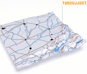 Places with similar names to Tamoujjout, Morocco ::
// Tamejjout (MA)
// Tamjout (MA)
// Tamjout (MA)
// Tamoujjout (MA)
// Tamajjout (MA)
// Tamejjaït (MA)
// Tamouajet (MA)
// Tahmajjout (MA)
// Demjata (SK)
// Temajadu (SL)
Disclaimer :: Information on this page comes without warranty of any kind |
||
|
Where is Tamoujjout? Elevation and coordinates ::
Latitude (lat): 32°29'0"N Longitude (lon): 6°7'0"W
Elevation (approx.): 982m (map arrows pan, magnifying glasses zoom) |
||
|
Visiting Tamoujjout? Hotel/Accommodation ::
Book a hotel in Tamoujjout Travel Guide ::
Buy a travel guide for Morocco rental cars ::
car rental offers GPS waypoint ::
download a GPX waypoint (PoI) of Tamoujjout for your GPS receiver
|
||