|
search place name
|
||
Cañgatba (Pampanga, Philippines)Cañgatba is a town in the Pampanga region of Philippines. An overview map of the region around Cañgatba is displayed below.
regional and 3d topo map of Cañgatba, Philippines ::

Cañgatba airports ::
The nearest airport is MNL - Manila Ninoy Aquino Intl, located 80.9 km south east of Cañgatba.
Other airports nearby include BAG - Baguio (145.1 km north), Nearby towns ::
Jalung (0.2km south east) //
Porac (1.1km north east) //
Pio (2.6km south west) //
Babo-pañgulu (2.6km north west) //
Lucsuan (2.6km south west) //
San Roque (2.6km south east) //
Palat (2.6km south) //
Sepungbulaun (2.9km south east) //
Dolores (3.2km north) //
Mancatian (3.2km north east) //
Balubad (3.7km south) //
Planas (4.0km south west) //
Tibu (4.1km north west) //
Pandan (4.1km north east) //
Bulac (4.1km north east) //
Mabical (4.0km north east) //
Manibaug Pasig (4.6km north east) //
Mitla (5.0km east) //
Tinajeros (5.2km north east) //
Carmen (5.6km south) //
Salu (5.6km south) //
Pasbul (5.8km north) //
Calantas (5.8km south) //
Manibaug Paralaya (5.9km north east) //
Pias (6.0km south east) //
Pulungmasle (6.3km south) //
San Francisco (6.4km south) //
Banaba (6.6km north west) //
San Vicente (6.6km south east) //
[all distances 'as the bird flies' and approximate] 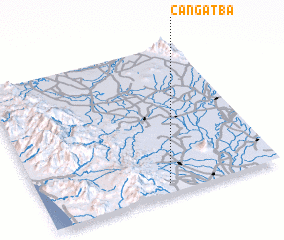 Places with similar names to Cañgatba, Philippines ::
Disclaimer :: Information on this page comes without warranty of any kind |
||
|
Where is Cañgatba? Elevation and coordinates ::
Latitude (lat): 15°4'0"N Longitude (lon): 120°32'0"E
Elevation (approx.): 72m (map arrows pan, magnifying glasses zoom) |
||
|
Visiting Cañgatba? Hotel/Accommodation ::
Book a hotel in Cañgatba Travel Guide ::
Buy a travel guide for Philippines rental cars ::
car rental offers GPS waypoint ::
download a GPX waypoint (PoI) of Cañgatba for your GPS receiver
|
||