|
search place name
|
||
Casamongan (Masbate, Philippines)Casamongan is a town in the Masbate region of Philippines. An overview map of the region around Casamongan is displayed below.
regional and 3d topo map of Casamongan, Philippines ::

Casamongan airports ::
The nearest airport is KLO - Kalibo, located 115.2 km south west of Casamongan.
Other airports nearby include BCD - Bacolod (167.0 km south), ILO - Iloilo (176.1 km south west), TAC - Tacloban Daniel Z Romualdez (207.1 km south east), NOP - Masbate Mactan Cebu Intl (209.6 km south), Nearby towns ::
Mabalantak (1.0km west) //
Panguiranan Daku (1.9km south west) //
Taisan (2.1km north east) //
Quinangan Diotay (2.8km south west) //
Calumpang (3.0km north east) //
Panguiranan (4.2km south west) //
Malobota (5.7km south west) //
Mobobolo (7.1km south west) //
Otod (8.1km south west) //
Bangad (9.5km north east) //
Ayat (9.9km north west) //
Canomoy (10.6km north west) //
Jangan (11.8km south west) //
[all distances 'as the bird flies' and approximate] 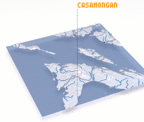 Places with similar names to Casamongan, Philippines :: Disclaimer :: Information on this page comes without warranty of any kind |
||
|
Where is Casamongan? Elevation and coordinates ::
Latitude (lat): 12°5'45"N Longitude (lon): 123°20'42"E
Elevation (approx.): 8m (map arrows pan, magnifying glasses zoom) |
||
|
Visiting Casamongan? Hotel/Accommodation ::
Book a hotel in Casamongan Travel Guide ::
Buy a travel guide for Philippines rental cars ::
car rental offers GPS waypoint ::
download a GPX waypoint (PoI) of Casamongan for your GPS receiver
|
||