|
search place name
|
||
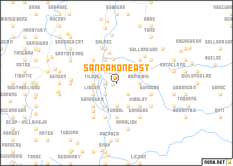
San Ramon East (Abra, Philippines)San Ramon East is a town in the Abra region of Philippines. An overview map of the region around San Ramon East is displayed below.
regional and 3d topo map of San Ramon East, Philippines ::
San Ramon East airports ::
The nearest airport is BAG - Baguio, located 115.7 km south of San Ramon East.
Nearby towns ::
San Ramon (0.7km south west) //
Daldalican (1.9km north) //
Dalimono (1.8km west) //
San Ramon West (1.8km west) //
Manabo (2.0km north west) //
Bangbang (2.6km south east) //
Luzong (2.6km north west) //
Bantaoay (2.6km north west) //
San Juan (2.6km north west) //
Lusong (2.6km north west) //
Cabaroan (2.6km south west) //
San Jose (2.9km north) //
Barisibis (3.5km east) //
Barbarit (3.7km south) //
Tilong (3.5km west) //
Catacdegan Viejo (3.9km north) //
Bantay (4.0km north east) //
San Jose Norte (4.1km north west) //
Ganaud (4.1km south east) //
Ucab (4.0km north west) //
Lacbauan (4.1km south west) //
Madago (4.1km south west) //
Anopol (4.0km south west) //
Madangdangla (4.0km south west) //
Liogan (4.0km south west) //
Patoc (5.0km north) //
San Guillermo (5.1km north east) //
Sorocok (5.1km north east) //
Kibalat (5.1km south east) //
[all distances 'as the bird flies' and approximate] 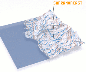 Places with similar names to San Ramon East, Philippines ::
// San Ramoncito (SV)
Disclaimer :: Information on this page comes without warranty of any kind |
||
|
Where is San Ramon East? Elevation and coordinates ::
Latitude (lat): 17°25'0"N Longitude (lon): 120°43'0"E
Elevation (approx.): 157m (map arrows pan, magnifying glasses zoom) |
||
|
Visiting San Ramon East? Hotel/Accommodation ::
Book a hotel in San Ramon East Travel Guide ::
Buy a travel guide for Philippines rental cars ::
car rental offers GPS waypoint ::
download a GPX waypoint (PoI) of San Ramon East for your GPS receiver
|
||