|
search place name
|
||
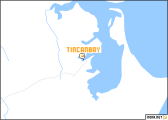
Tin Can Bay (Queensland, Australia)Tin Can Bay is a town in the Queensland region of Australia. An overview map of the region around Tin Can Bay is displayed below.
regional and 3d topo map of Tin Can Bay, Australia ::
Tin Can Bay airports ::
The nearest airport is MCY - Maroochydore Sunshine Coast, located 76.6 km south of Tin Can Bay.
Other airports nearby include BNE - Brisbane Intl (163.0 km south), Nearby towns ::
[all distances 'as the bird flies' and approximate]  Places with similar names to Tin Can Bay, Australia ::
// Dan Ganabay (NE)
// Dunqunāb (SD)
// Duncan Bay (CA)
// Dongneibu (CN)
// Duancunbu (CN)
// Tawnkawnba (SL)
Disclaimer :: Information on this page comes without warranty of any kind |
||
|
Where is Tin Can Bay? Elevation and coordinates ::
Latitude (lat): 25°55'0"S Longitude (lon): 153°0'0"E
Elevation (approx.): 10m (map arrows pan, magnifying glasses zoom) |
||
|
Visiting Tin Can Bay? Hotel/Accommodation ::
Book a hotel in Tin Can Bay Travel Guide ::
Buy a travel guide for Australia rental cars ::
car rental offers GPS waypoint ::
download a GPX waypoint (PoI) of Tin Can Bay for your GPS receiver
|
||