|
search place name
|
||
Bergantín (Puerto Plata, Dominican Republic)Bergantín is a town in the Puerto Plata region of Dominican Republic. An overview map of the region around Bergantín is displayed below.
regional and 3d topo map of Bergantín, Dominican Republic ::

Bergantín airports ::
The nearest airport is POP - Puerto Plata Gregorio Luperon Intl, located 5.0 km east of Bergantín.
Other airports nearby include STI - Santiago Cibao Intl (39.9 km south), CAP - Cap Haitien Intl (165.4 km west), BRX - Barahona Maria Montez Intl (175.9 km south), SDQ - Santo Domingo Las Americas Intl (178.5 km south east), Nearby towns ::
Boca Nueva (0.0km north) //
El Rincón (2.5km south east) //
Cantabria (3.5km west) //
Boca de Cangrejos (3.5km east) //
Juan de Nina Muñoz (3.7km south) //
Muñoz (4.0km south west) //
Sabaneta de Cangrejos (4.0km south east) //
Monte Llano (4.1km south east) //
Limoncillo (5.1km south east) //
La Gran Parada (5.6km south) //
Sabana Grande (5.2km west) //
Los Ciruelos (5.6km south) //
Loma del Medio (5.8km south) //
Cantabria Abajo (5.6km west) //
Los Muertos (5.8km south) //
Mozoví (6.6km south east) //
Arroyo Caraballo (6.6km south east) //
Holguín (6.4km south east) //
Sampiñé (7.0km west) //
La Unión (7.0km east) //
Camú (7.4km south) //
Guaimosa (7.4km south) //
Los Mameyes (7.2km west) //
Arroyo Blanco (7.6km south east) //
Jarda de las Canas (7.6km south east) //
Sabana de la Vigía (7.6km south west) //
San Felipe de Puerto Plata (7.9km north west) //
Cantabria Arriba (7.9km south west) //
Juan de Nina (8.2km south west) //
[all distances 'as the bird flies' and approximate] 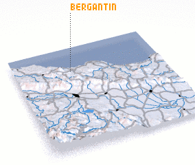 Places with similar names to Bergantín, Dominican Republic ::
// Brückentin (DE)
// Bargaintown (US)
// Brigantine (US)
// Brackentown (US)
// Bergantín (VE)
// Brigandin (GF)
// Bergantino (IT)
// Berganton (FR)
// Bourgnaudin (FR)
Disclaimer :: Information on this page comes without warranty of any kind |
||
|
Where is Bergantín? Elevation and coordinates ::
Latitude (lat): 19°46'0"N Longitude (lon): 70°37'0"W
Elevation (approx.): -32768m (map arrows pan, magnifying glasses zoom) |
||
|
Visiting Bergantín? Hotel/Accommodation ::
Book a hotel in Bergantín Travel Guide ::
rental cars ::
car rental offers GPS waypoint ::
download a GPX waypoint (PoI) of Bergantín for your GPS receiver
|
||