|
search place name
|
||
La Cana (Espaillat, Dominican Republic)La Cana is a town in the Espaillat region of Dominican Republic. An overview map of the region around La Cana is displayed below.
regional and 3d topo map of La Cana, Dominican Republic ::

La Cana airports ::
The nearest airport is POP - Puerto Plata Gregorio Luperon Intl, located 29.1 km north west of La Cana.
Other airports nearby include STI - Santiago Cibao Intl (40.5 km south west), SDQ - Santo Domingo Las Americas Intl (151.3 km south east), BRX - Barahona Maria Montez Intl (176.4 km south west), CAP - Cap Haitien Intl (197.1 km west), Nearby towns ::
La Caña (1.7km west) //
Veragua Abajo (1.7km west) //
La Jagüita (1.9km south) //
Gen (1.7km east) //
La Damajagua (2.5km south west) //
Caño Dulce (2.5km south east) //
Arroyo Hondo (3.5km east) //
Los Guaos (4.1km south west) //
Los Rincones (4.1km south east) //
Arenoso (4.0km south east) //
Alto Grande (5.1km south west) //
La Lometa (5.1km north west) //
Saltadero (5.1km south east) //
Gaspar Hernández (5.1km south east) //
El Caimán (5.1km south east) //
Colonia de Veragua (5.6km south) //
Los Franceses (5.6km east) //
Bajada de Alto Grande (5.6km west) //
Boca del Anón (5.8km south) //
Las Angosturas (5.8km south) //
Los Cacaítos (5.8km south) //
La Cruz (5.8km south) //
Cruce de Veragua (5.6km west) //
Hoya Grande (6.4km south east) //
La Sigua (6.4km south east) //
Rincón (6.4km north west) //
La Piña (6.4km north west) //
La Jina (7.4km south) //
Sabaneta de Yásica (7.2km west) //
[all distances 'as the bird flies' and approximate] 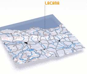 Places with similar names to La Cana, Dominican Republic ::
Disclaimer :: Information on this page comes without warranty of any kind |
||
|
Where is La Cana? Elevation and coordinates ::
Latitude (lat): 19°39'0"N Longitude (lon): 70°19'0"W
Elevation (approx.): 22m (map arrows pan, magnifying glasses zoom) |
||
|
Visiting La Cana? Hotel/Accommodation ::
Book a hotel in La Cana Travel Guide ::
rental cars ::
car rental offers GPS waypoint ::
download a GPX waypoint (PoI) of La Cana for your GPS receiver
|
||