|
search place name
|
||
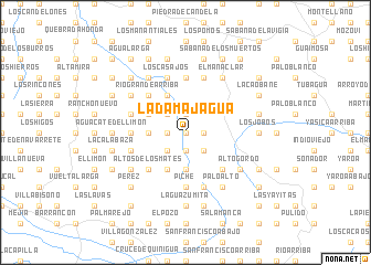
La Damajagua (Puerto Plata, Dominican Republic)La Damajagua is a town in the Puerto Plata region of Dominican Republic. An overview map of the region around La Damajagua is displayed below.
regional and 3d topo map of La Damajagua, Dominican Republic ::
La Damajagua airports ::
The nearest airport is POP - Puerto Plata Gregorio Luperon Intl, located 22.0 km north east of La Damajagua.
Other airports nearby include STI - Santiago Cibao Intl (28.6 km south east), CAP - Cap Haitien Intl (153.6 km west), BRX - Barahona Maria Montez Intl (158.3 km south), SDQ - Santo Domingo Las Americas Intl (174.1 km south east), Nearby towns ::
Pescado Bobo (0.0km north) //
Píe de Jagua (0.0km north) //
La Vereda (0.0km north) //
El Almacén (0.0km north) //
La Jagua (1.7km east) //
Rancho Arriba (1.9km south) //
El Manguito (1.9km north) //
La Sabaneta (1.7km west) //
El Guazaral (2.5km south east) //
La Cruz (2.5km south west) //
Corozo (2.5km south west) //
Rancho Viejo (2.5km north west) //
Los Mangos (2.5km north west) //
Cuesta de Úrsula (3.7km south) //
Los Pomos (3.7km south) //
Palmarito (3.7km south) //
Pie Jagua (3.5km west) //
Manaclas (4.1km south west) //
Pescado Bobo Arriba (4.1km north west) //
La Cueva (4.0km north west) //
El Hoyazo (5.1km south east) //
Altos de los Mates (5.1km south west) //
Los Chicharrones (5.1km south west) //
Río Grande (5.1km north west) //
Río Grande Arriba (5.1km north west) //
Las Aguas (5.2km west) //
Escalera (5.2km west) //
Piche (5.6km south) //
Bajaboniquito (5.6km north) //
[all distances 'as the bird flies' and approximate] 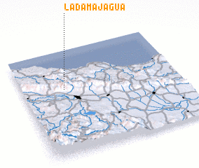 Places with similar names to La Damajagua, Dominican Republic ::
// La Demajagua (CU)
// La Demajagua (CU)
// La Demajagua (CU)
// La Damajagua (DO)
// La Damajagua (DO)
// La Demajagua (DO)
// La Demajagua (DO)
Disclaimer :: Information on this page comes without warranty of any kind |
||
|
Where is La Damajagua? Elevation and coordinates ::
Latitude (lat): 19°38'0"N Longitude (lon): 70°44'0"W
Elevation (approx.): 365m (map arrows pan, magnifying glasses zoom) |
||
|
Visiting La Damajagua? Hotel/Accommodation ::
Book a hotel in La Damajagua Travel Guide ::
rental cars ::
car rental offers GPS waypoint ::
download a GPX waypoint (PoI) of La Damajagua for your GPS receiver
|
||