|
search place name
|
||
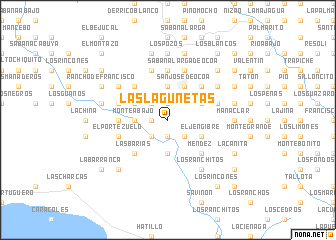
Las Lagunetas (Peravia, Dominican Republic)Las Lagunetas is a town in the Peravia region of Dominican Republic. An overview map of the region around Las Lagunetas is displayed below.
regional and 3d topo map of Las Lagunetas, Dominican Republic ::
Las Lagunetas airports ::
The nearest airport is BRX - Barahona Maria Montez Intl, located 70.2 km south west of Las Lagunetas.
Other airports nearby include SDQ - Santo Domingo Las Americas Intl (90.1 km east), STI - Santiago Cibao Intl (98.9 km north), POP - Puerto Plata Gregorio Luperon Intl (137.5 km north), LRM - La Romana Casa De Campo Intl (169.6 km east), Nearby towns ::
La Manaclita (1.8km west) //
Los Báez (1.9km north) //
La Sabaneta (1.9km south) //
La Agüita (2.6km north west) //
La Toronja (2.6km north west) //
Río Abajo del Memiso (2.6km south west) //
Castillo (2.6km south west) //
Loma de los Helechos (2.6km south west) //
Angelito (2.6km south east) //
Monte Abajo (3.5km west) //
El Corbanal (3.5km west) //
La Isleta (3.5km west) //
Los Helechos (3.5km west) //
La Sabana (3.7km north) //
La Peñita (3.7km south) //
Los Cascajales de Sánchez (3.7km south) //
Hanaclita (4.0km north west) //
Las Piedras Malas (4.0km north west) //
San José de Ocoa (4.1km north east) //
Tumbaca (4.0km north east) //
El Tamarindo (4.0km north east) //
Parra (4.0km north east) //
El Jengibre (4.0km south east) //
Los Calabacitos (5.1km north west) //
El Pinar (5.1km north west) //
Las Barías (5.1km south west) //
Ojo de Agua (5.1km north east) //
Los Naranjos (5.1km south east) //
El Limón (5.1km south east) //
[all distances 'as the bird flies' and approximate]  Places with similar names to Las Lagunetas, Dominican Republic ::
// Las Lagunitas (PA)
// Las Lagunitas (PA)
// Las Lagunitas (PA)
// Las Lagunetas (ES)
// Las Lagunetas (ES)
// Las Lagunetas (MX)
// Las Lagunitas (MX)
// Las Lagunitas (MX)
// Las Lagunitas (MX)
// Los Alicantes (MX)
Disclaimer :: Information on this page comes without warranty of any kind |
||
|
Where is Las Lagunetas? Elevation and coordinates ::
Latitude (lat): 18°31'0"N Longitude (lon): 70°31'0"W
Elevation (approx.): 445m (map arrows pan, magnifying glasses zoom) |
||
|
Visiting Las Lagunetas? Hotel/Accommodation ::
Book a hotel in Las Lagunetas Travel Guide ::
rental cars ::
car rental offers GPS waypoint ::
download a GPX waypoint (PoI) of Las Lagunetas for your GPS receiver
|
||