|
search place name
|
||
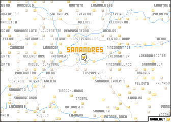
San Andrés (Elías Piña, Dominican Republic)San Andrés is a town in the Elías Piña region of Dominican Republic. An overview map of the region around San Andrés is displayed below.
regional and 3d topo map of San Andrés, Dominican Republic ::
San Andrés airports ::
The nearest airport is PAP - Port-au-prince Toussaint Louverture Intl, located 82.6 km south west of San Andrés.
Other airports nearby include CAP - Cap Haitien Intl (92.7 km north west), BRX - Barahona Maria Montez Intl (106.5 km south east), STI - Santiago Cibao Intl (120.1 km east), POP - Puerto Plata Gregorio Luperon Intl (140.8 km north east), Nearby towns ::
Nicó (0.0km north) //
Los Jobitos (0.0km north) //
El Papayo (1.8km east) //
Los Pinos (1.9km north) //
El Guayabo (1.9km south) //
Tocino (1.8km west) //
Sabana Cruz (1.8km west) //
La Sierrecita (2.6km north east) //
La Caobita (2.6km north east) //
Sabana Grande (2.6km north west) //
El Mamoncito (2.6km south west) //
Corral de Alcántara (2.6km south west) //
La Cruz (3.7km north) //
El Tabacal (3.7km north) //
Los Cercadillos (3.7km north) //
El Anón (4.1km south east) //
Los Yareyes (4.1km south east) //
El Cucurucho (4.0km north east) //
Las Cañitas (4.0km north east) //
Bánica (4.1km north west) //
Hato Viejo (5.3km west) //
Latines (5.6km west) //
El Hoyo (5.6km east) //
El Blanco (5.6km west) //
Marisabel (5.6km east) //
Pedro Santana (5.8km north) //
Los Patios (5.8km north) //
Lociane (6.4km north west) //
Descubierta (6.6km north east) //
[all distances 'as the bird flies' and approximate]  Places with similar names to San Andrés, Dominican Republic ::
// San Andres (BZ)
// San Andreas (US)
// San Andrés (PA)
// San Andrés (PA)
// San Andrés (CU)
// San Andrés (CU)
// San Andrés (CU)
// San Andrés (CU)
// San Andrés (CU)
// San Andrés (CU)
Disclaimer :: Information on this page comes without warranty of any kind |
||
|
Where is San Andrés? Elevation and coordinates ::
Latitude (lat): 19°3'0"N Longitude (lon): 71°41'0"W
Elevation (approx.): 296m (map arrows pan, magnifying glasses zoom) |
||
|
Visiting San Andrés? Hotel/Accommodation ::
Book a hotel in San Andrés Travel Guide ::
rental cars ::
car rental offers GPS waypoint ::
download a GPX waypoint (PoI) of San Andrés for your GPS receiver
|
||